Lofoten Photography Locations: Honeypots, Rainbows, and a Truly Biblical Amount of Rain
Lofoten photography: the quick version
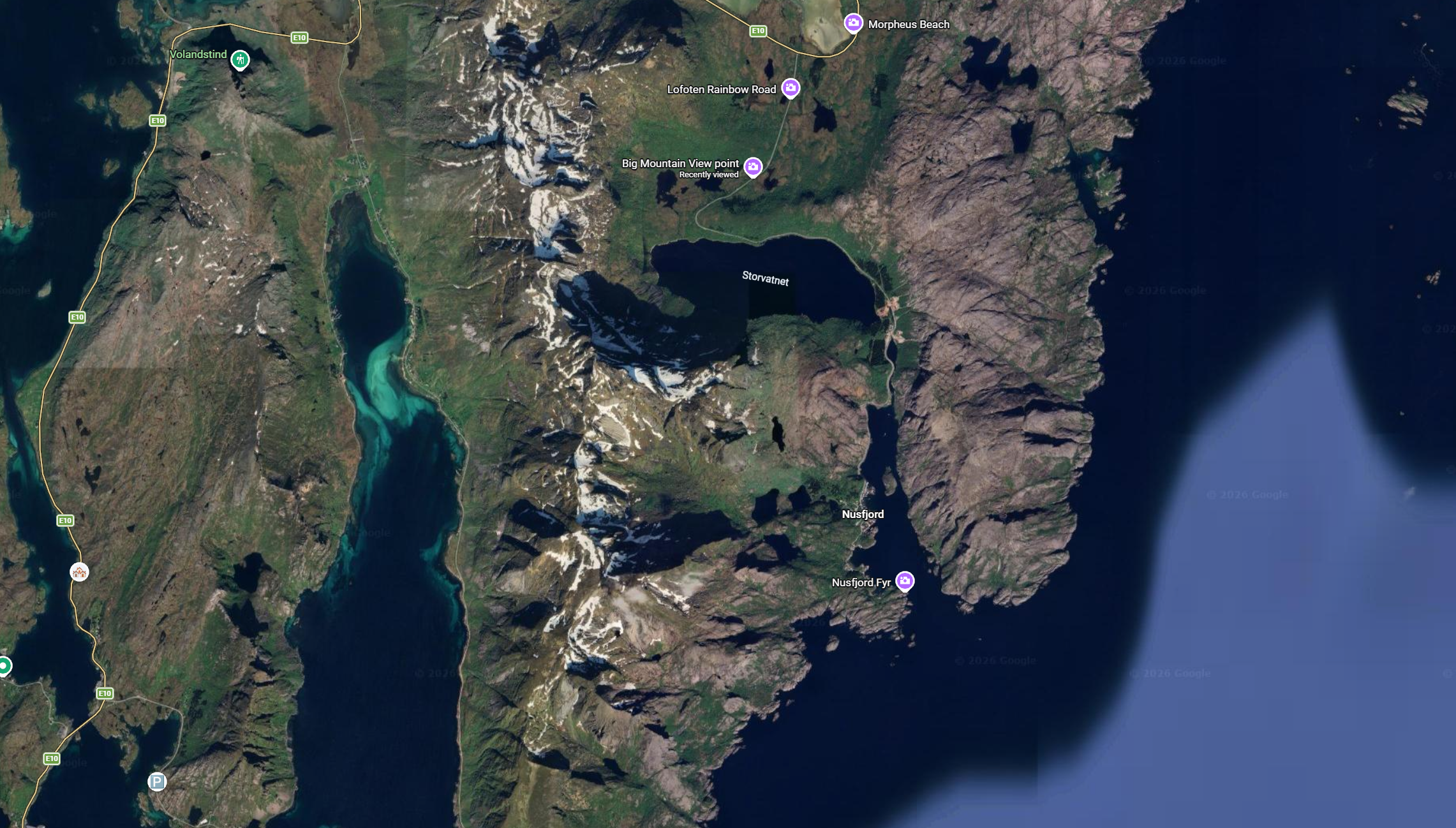
- Where: The Lofoten archipelago, Arctic Norway, strung along one road (the E10) from Svolvær down to the village of Å
- Getting there: Fly into Svolvær or Leknes (usually via Bodø), or drive the E10 in as we did, coming south from Tromsø and Senja. A hire car is essential.
- When we went: November. Short days, a low winter sun, a lot of rain, and aurora on the cards.
- Best photo spots: Reine, Hamnøy, Sakrisøy (the yellow huts), Nusfjord, Henningsvær (the football pitch), Fredvang, Uttakleiv, Sund and Å
- The big climb: Reinebringen, nearly 2,000 steps, covered in its own guide
- In the bag: Sony A7R V, DJI Air 3 drone (near essential here), polariser and ND filter, a full-spectrum infrared camera for grey days, and the Fujifilm X100VI
- Worth knowing: It rains. Heavily. The grimmest days often handed us the best light, rainbows included. And watch the bridge shadow at Hamnøy in winter.
Here's the honest version. We rolled into Lofoten straight off the back of Senja, which had been quiet, dramatic and largely ours, and the first thing Lofoten did was rain on us. Then it rained some more. Then, for shits and giggles, it rained sideways.
Lofoten is the famous one. It's the place every landscape photographer has on the list, the islands you've seen a thousand times when you doom scroll social media, and that popularity is entirely earned. The catch is that "famous" also means honeypots, other tripods, other people… how dare they!!
We went in November which gave us a very low winter sun that pops up over the horizon mid morning and ducks behind the mountains by mid-afternoon. So this is less a glossy highlight reel and more a real account of where I pointed the camera over a week of varied weather, what worked, and the spots worth your time when you go. Because you should go.
Just pack your waterproofs…
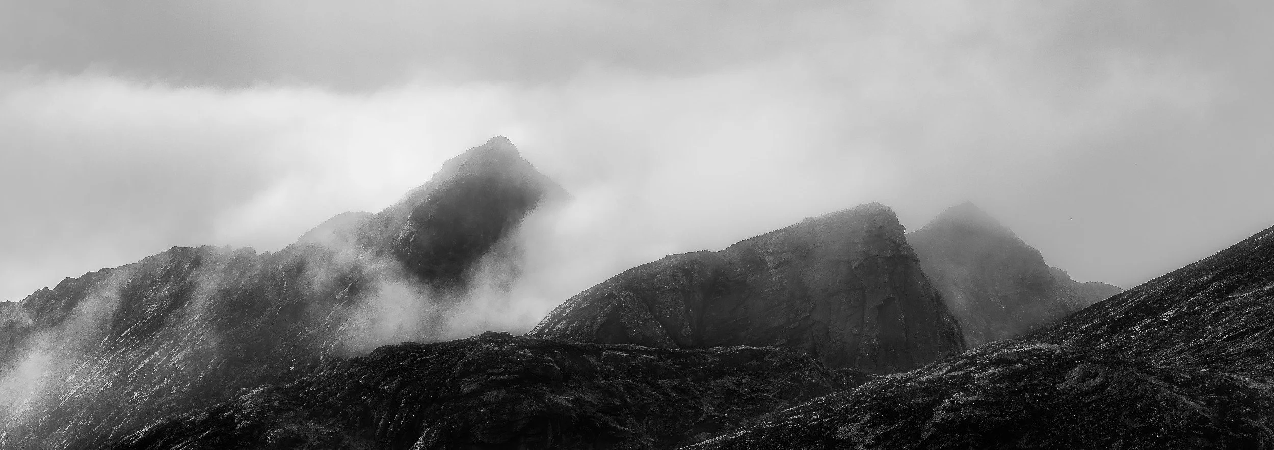
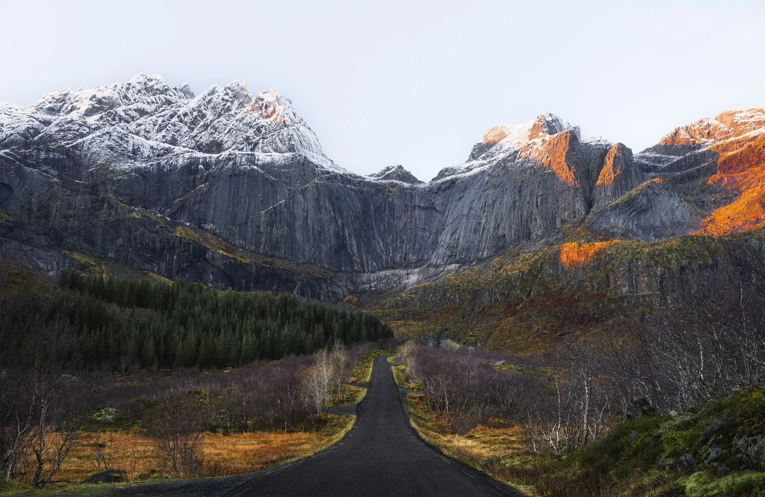
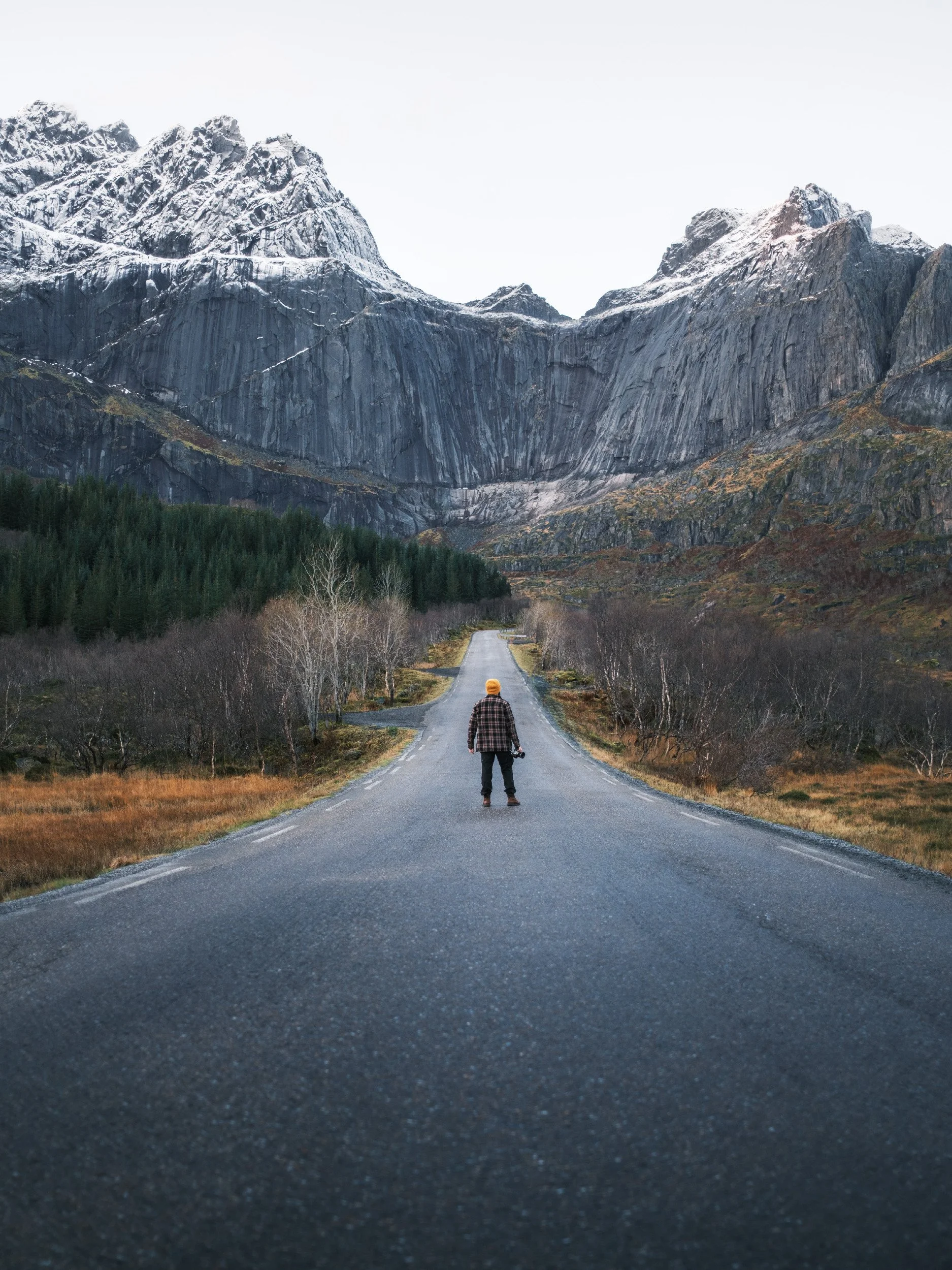
Moody peaks on the Drive from Senja to Lofoten
Worth knowing: the moody roadside shots I took on the drive down from Svolvær the day before were amazing. I was bleary, under-caffeinated, and enjoying the surroundings (when it was Cas’s turn to drive) more than I was concentrating on the photography. Moral of the story, always keep your eyes peeled!
Roadside spot, somewhere off the E10 on the drive from Svolvær to Reine
Lofoten in a nutshell, and the bits Few photograph
Lofoten (roughly "LOH-foo-ten", although watch my Youtube Video to see how bad my pronunciation was…) is an archipelago strung off the coast of Arctic Norway, joined up by a single ribbon of road, the E10, that threads bridge to bridge from Svolvær down to the village of Å at the very bottom. That road will become the spine of your adventure. Almost everything you want to shoot is a short hop off it.
Moody views on the E10
The honest part is the light. In late autumn and winter you're working with a handful of usable hours and a sun that never climbs far, which is gorgeous when it shows up and brutal when it doesn't. We got plenty of the doesn't. But Lofoten has a habit of saving its best for the worst weather, and the days that looked most hopeless gave me some of my favourite frames of the entire trip. Keep that in mind every time you're tempted to stay in with the kettle on. Tempting though it is.
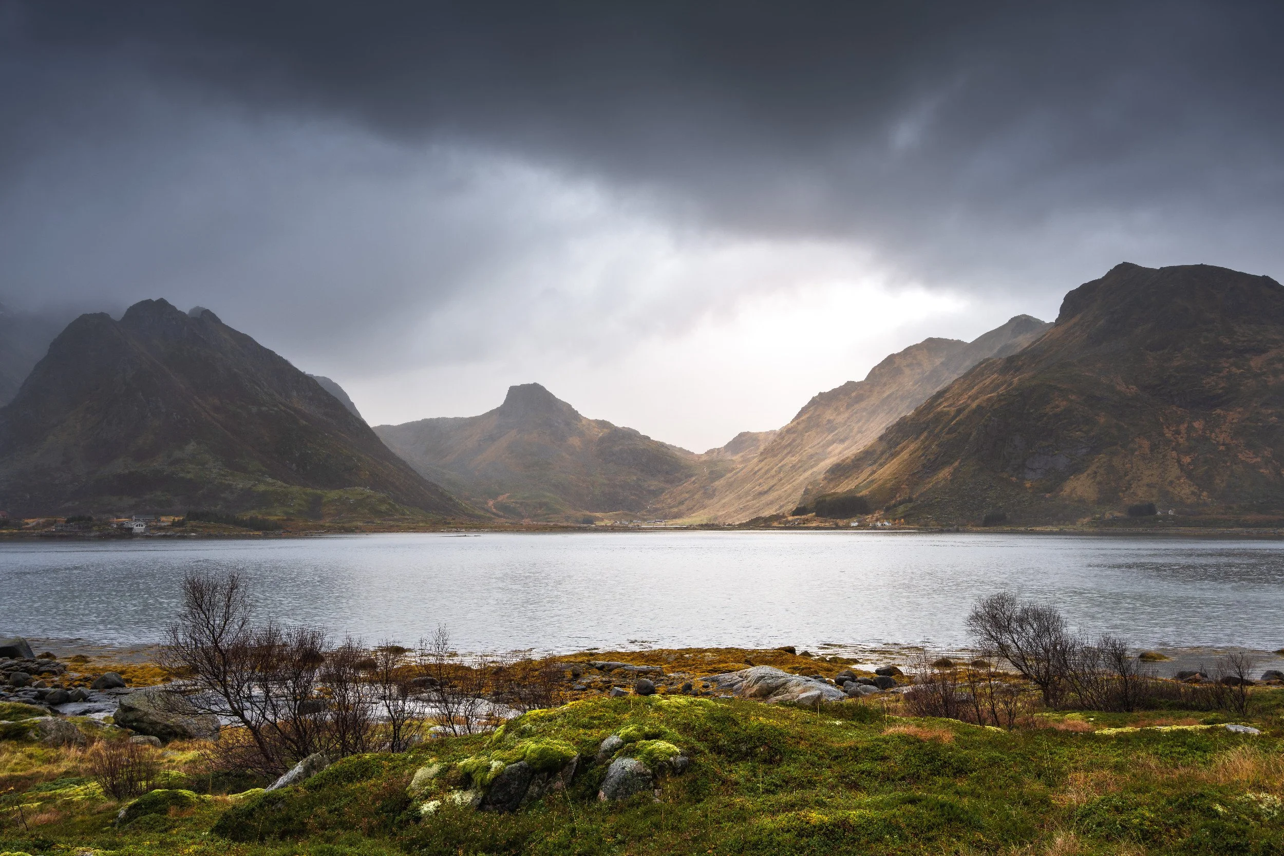
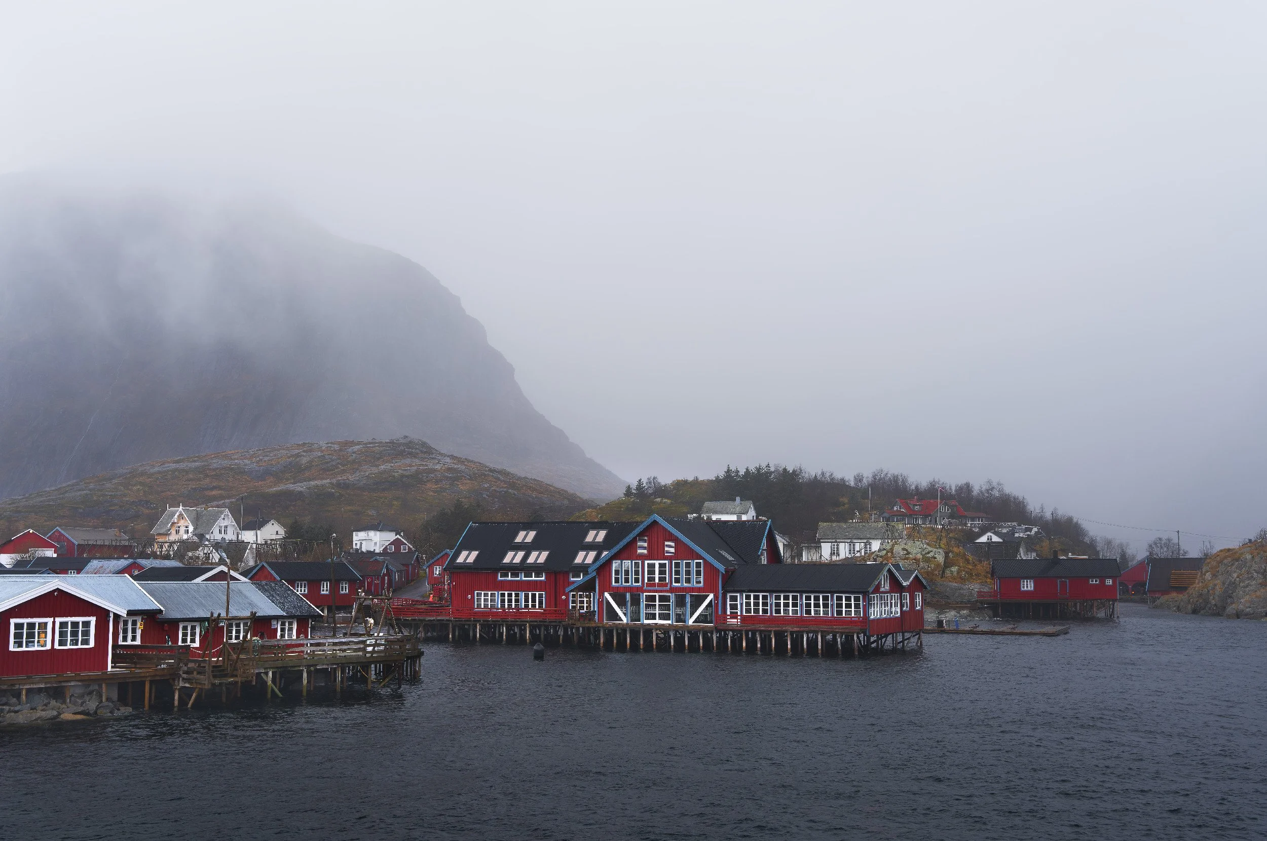
Sund: the warm-up that wasn't meant to be the warm-up
Our first proper morning was at Sund, a working fishing hamlet about three minutes from where we were staying. There was the usual bank of cloud sitting on the horizon refusing to let the sun through, and then, slowly it lifted, the peaks in front of me started to light up.
The coastline here is all lovely dark rock and there's a bridge just along from the village, plus a frankly unglamorous fish processing plant in the middle of it all. People have to eat. I shot it anyway.
Sund & Sun behind, looking north with the drone
We stopped just before we got to the village, where there was a safe spot to park the car and headed out onto the rocks. The foreground / background combinations here weren’t necessarily portfolio worthy, but lovely nonetheless. I was in the mood for something a little less honeypot to kick off the adventure.
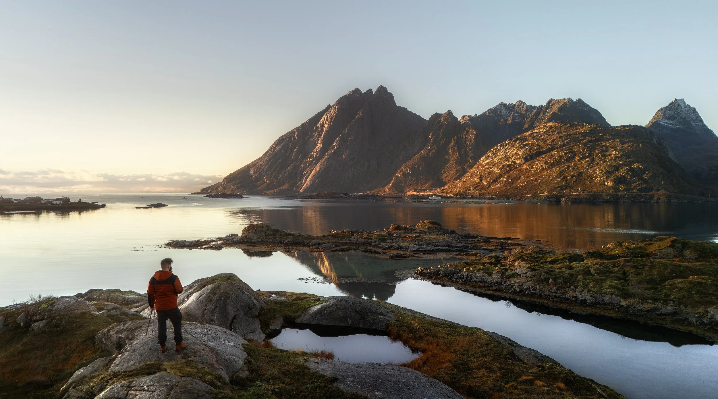
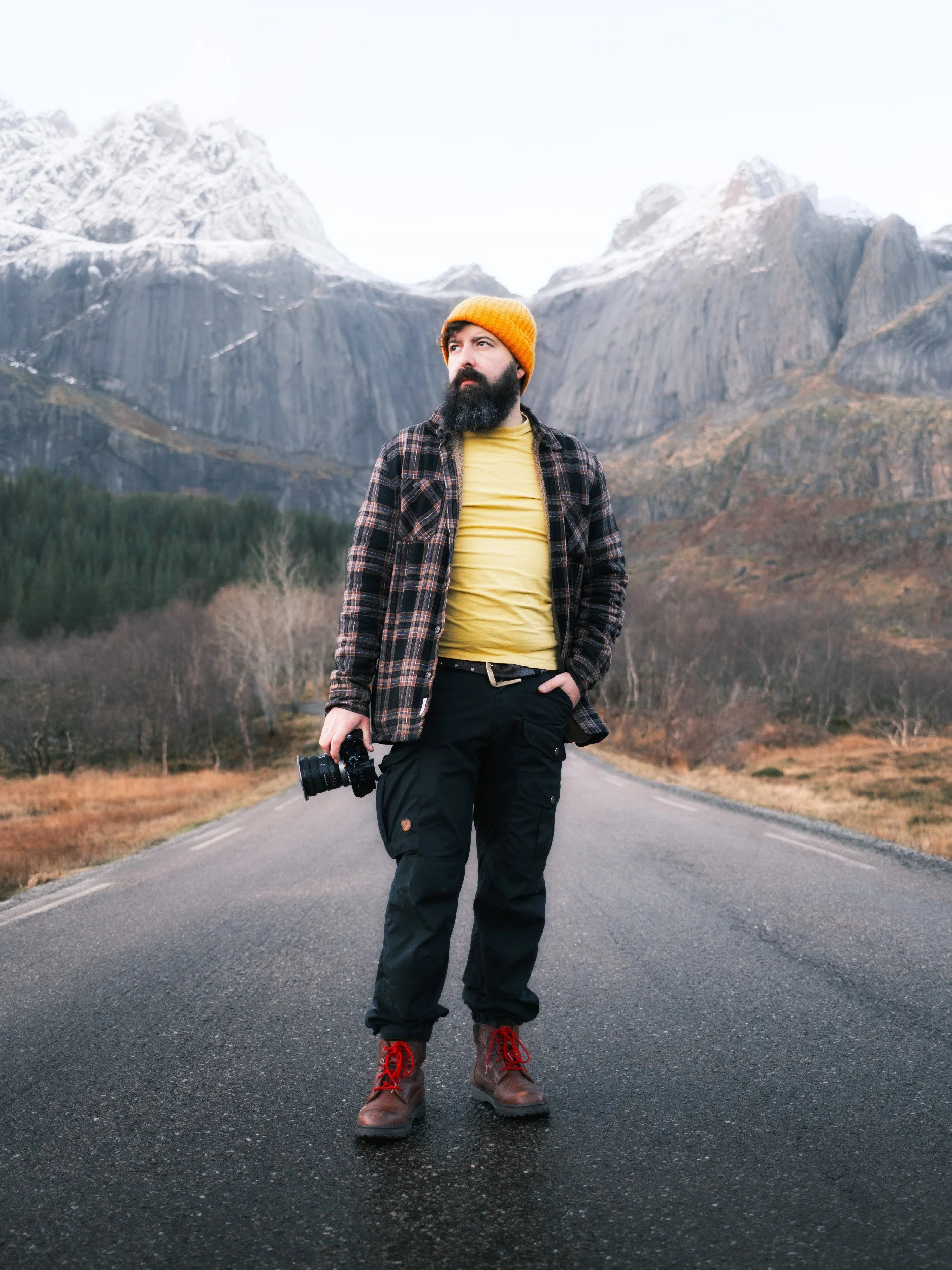
Me, watching the world slowly go by
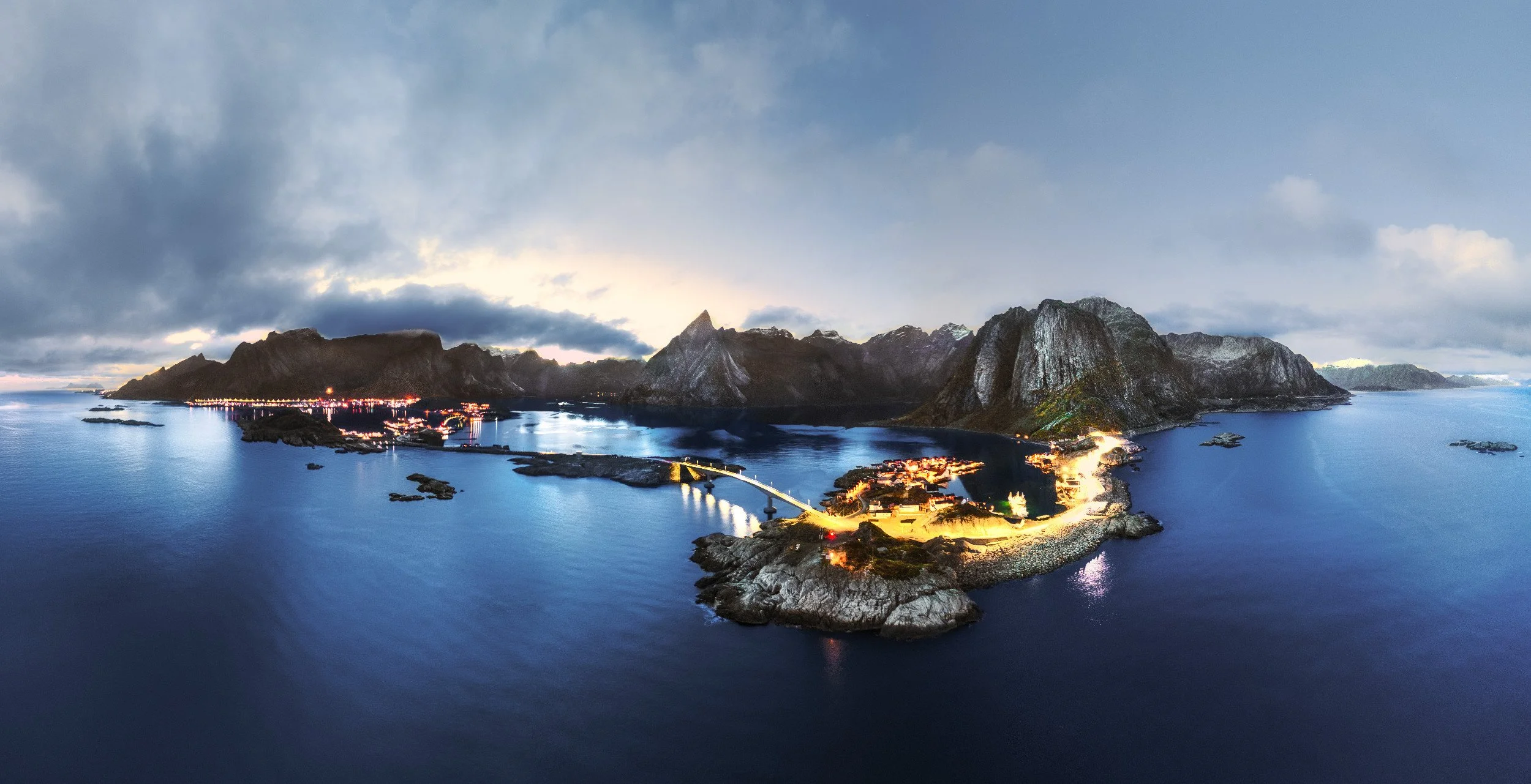
Reine: honeypot headquarters
If Lofoten has a capital, it's Reine (say "RYE-nuh"), and you'll use it as the hub for the famous stuff. We spent the first evening simply scouting it, working out where the light lands and when, because you have to bag the honeypot shots while you're here and it pays to know your timings before you commit a sunrise to them.
The harbour in Reine
The shot I didn't plan was the one I loved most. Popping into the Co-op in Reine for supplies, I caught the moon climbing over the horizon with a boat crossing in front of it and a couple of red huts on the harbour. Bloody glorious, and entirely accidental!!
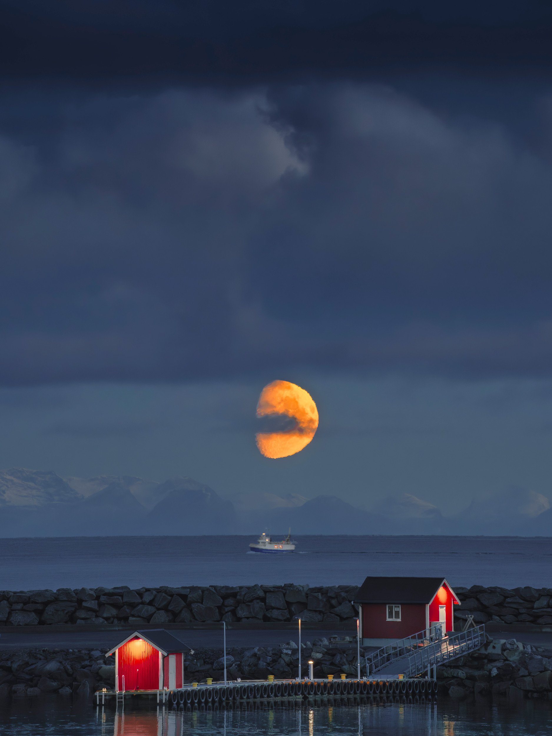
Moon Rise in Reine
Blue hour in Lofoten
Later that first day, from a viewpoint at the top of the village, I put the drone up for some night and blue-hour work while Cas kept warm in the car. I hadn't flown at night much before, the DJI's night mode coped well in blue hour and got twitchy as it darkened, and my automated panos overexposed where the last of the sun sat. Learning on the spot, as ever. Some of it stuck.
We obviously returned to this string of villages many times. When the rain passes through, we got rainbows a plenty as well as probably THE most dramatic panorama I have EVER shot!!
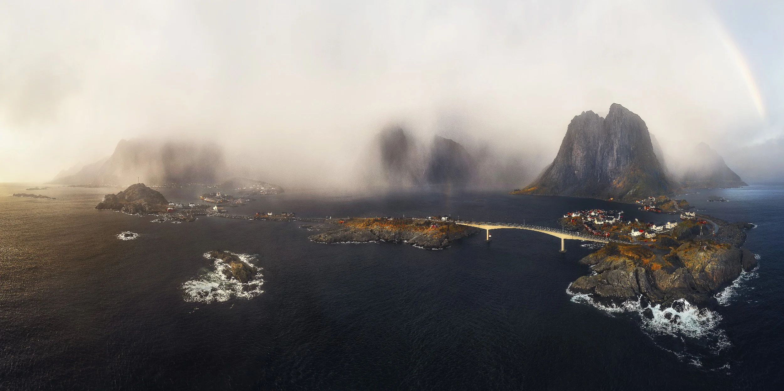
Hamnoy to Reine - A dream panorama shot
Hamnoy: the most photographed Scene in Norway
If you've been anywhere on the internet, you've seen Hamnoy (Hamnøy) shot from the eastern end of the bridge. The red rorbuer (traditional Norwegian fishermen’s cabins built on stilts directly over the water), the impossible and ancient peaks behind, the lot. It's a cliché for the simple reason that it's stunning, and it's one you have to take for your own portfolio. No apologies for that.
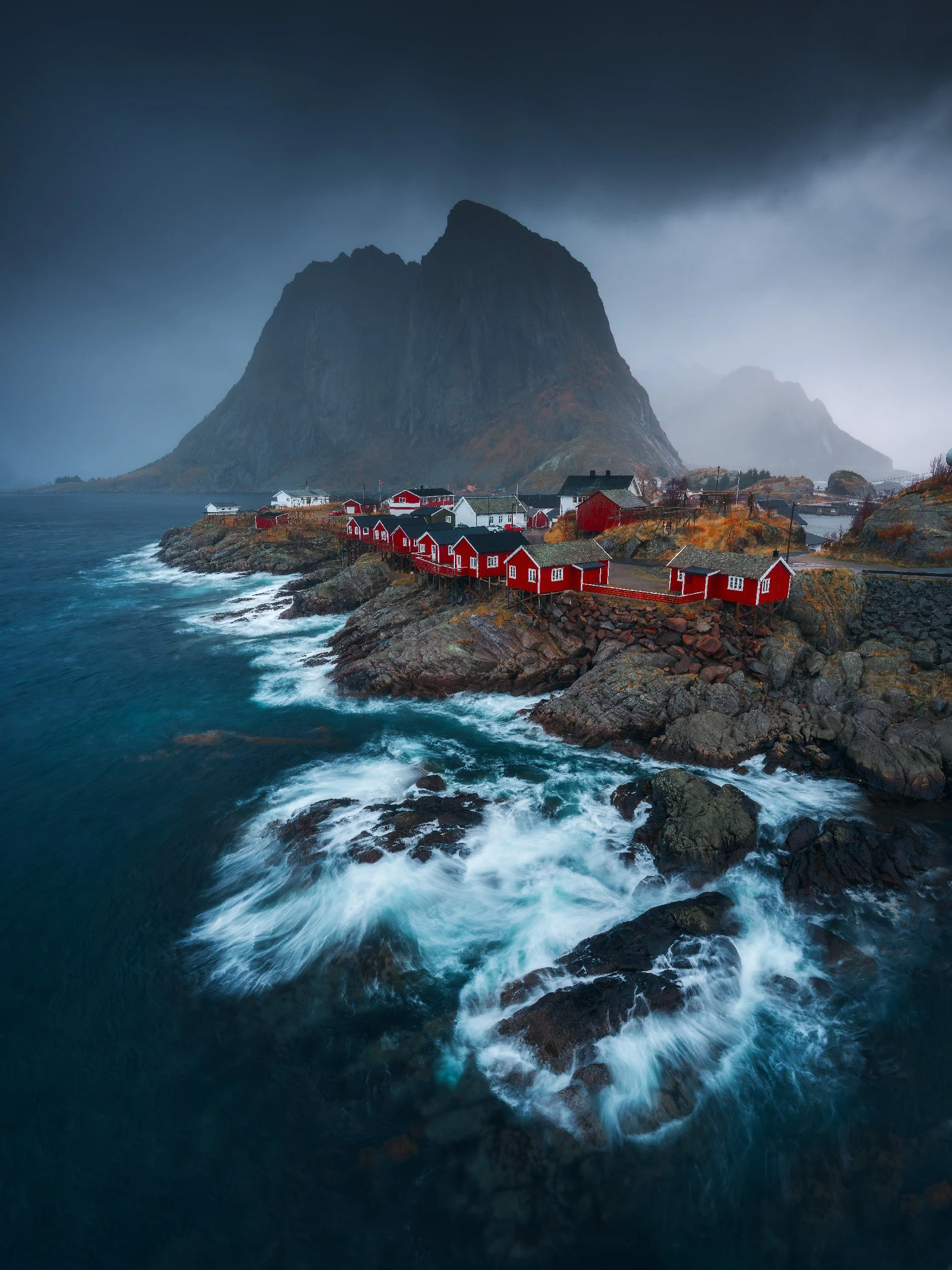
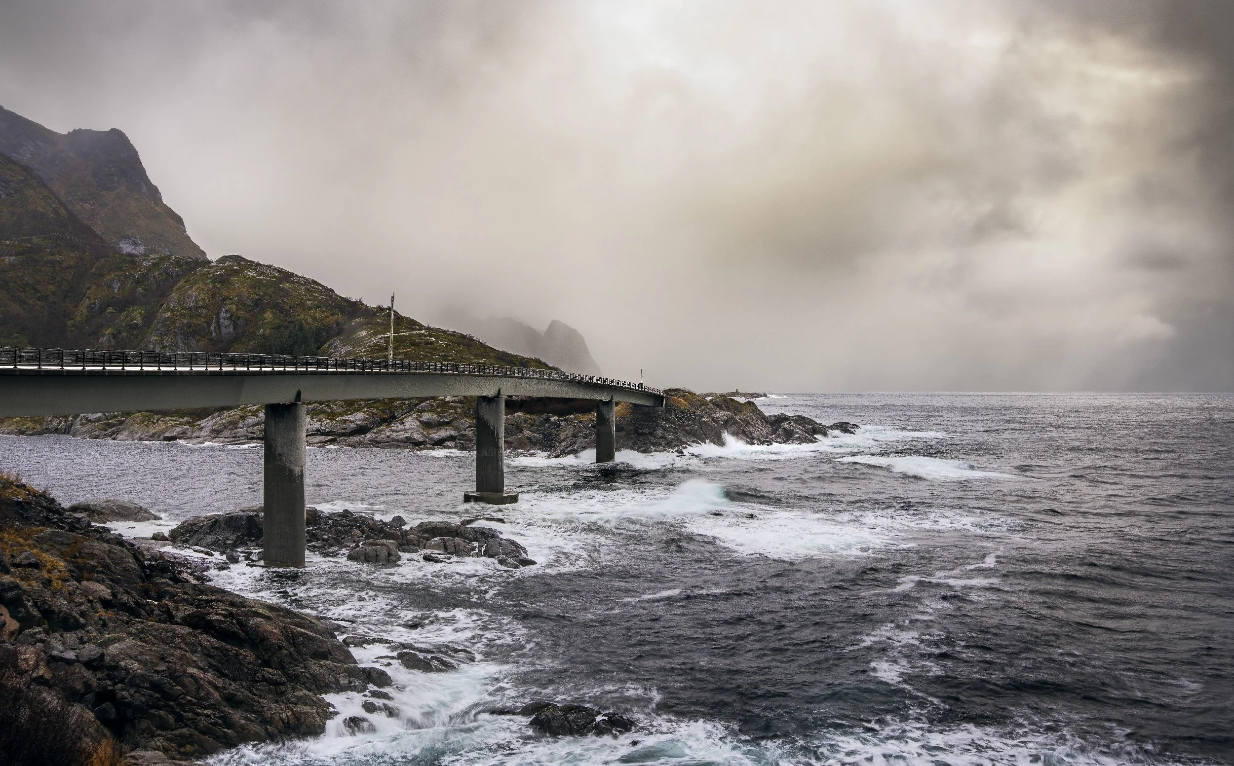
Classic shot from between the railing on the Bridge on a moody day
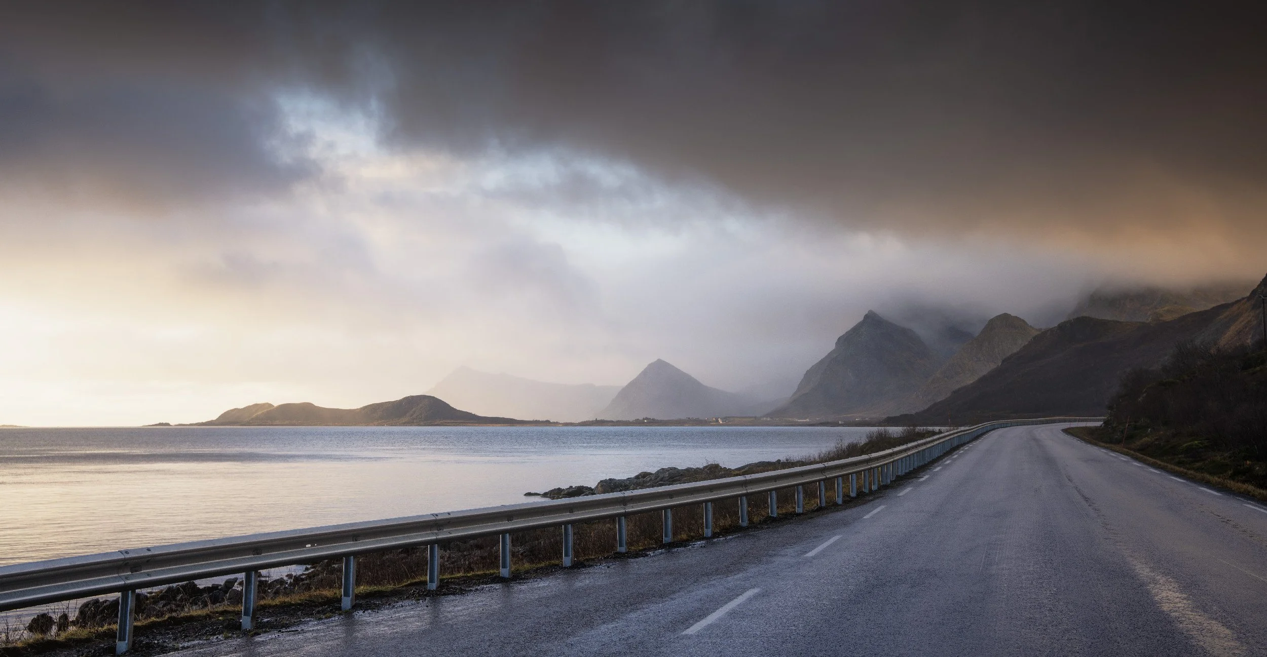
Two practical notes. First, at this time of year, watch the shadow the bridge itself throws across the foreground as the sun drops, because it can quietly wreck an otherwise clean composition.
Second, do not write Hamnoy off on a grim day. We came back here again and again, and it rewarded us every time. One morning I put the drone up with rain rolling through and caught a full circular rainbow sitting right over the village with the mountains in the middle. I have famously rotten luck with rainbows. Lofoten decided to make up for years of it in one go.
We also had a crack at the northern lights from here, though a fat full moon washed most of it out and, with not a great deal of solar activity, the final aurora shot ended up being a little underwhelming. Then the clouds rolled in! You take what you're given.
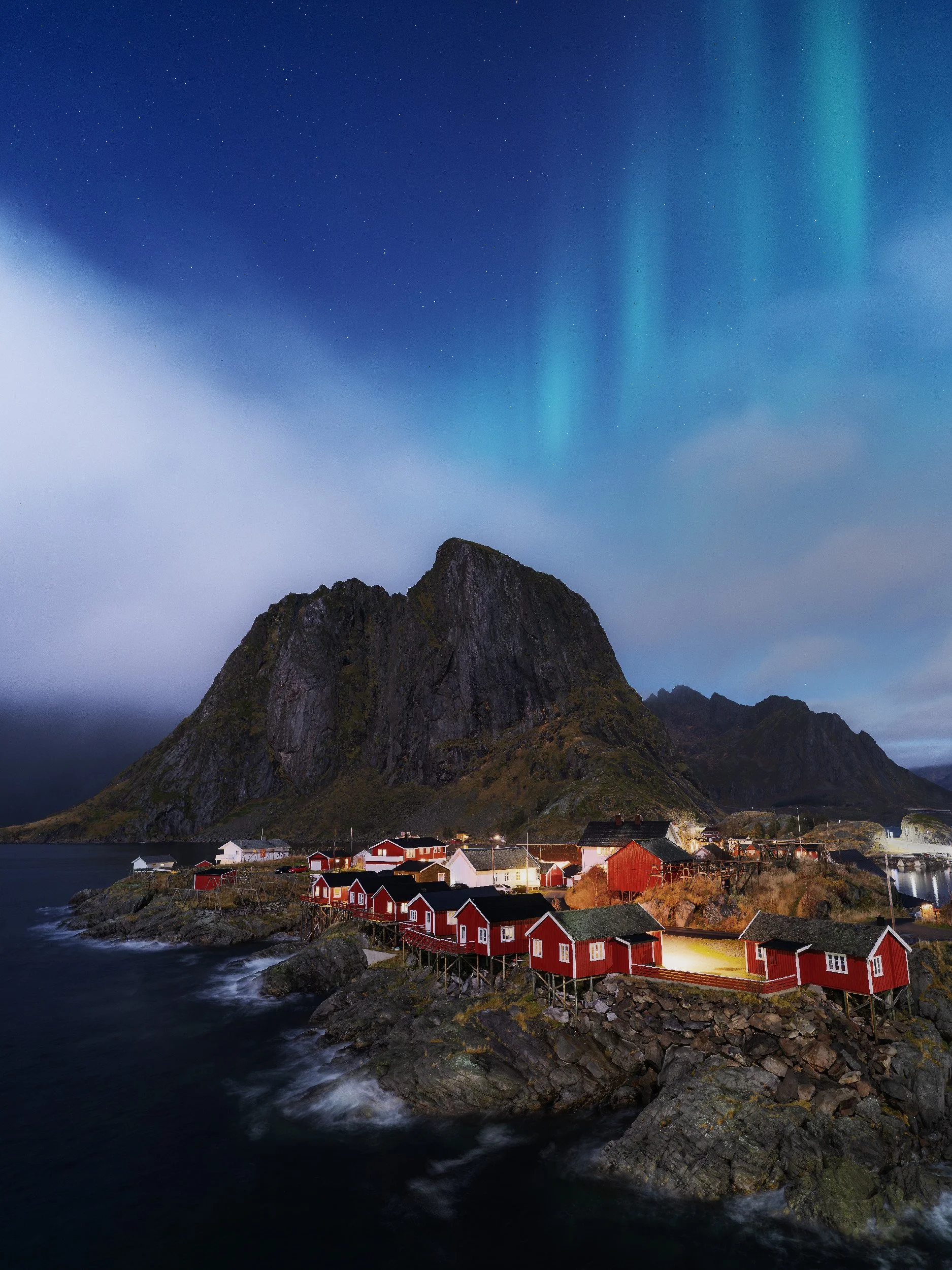
Aurora at Hamnoy
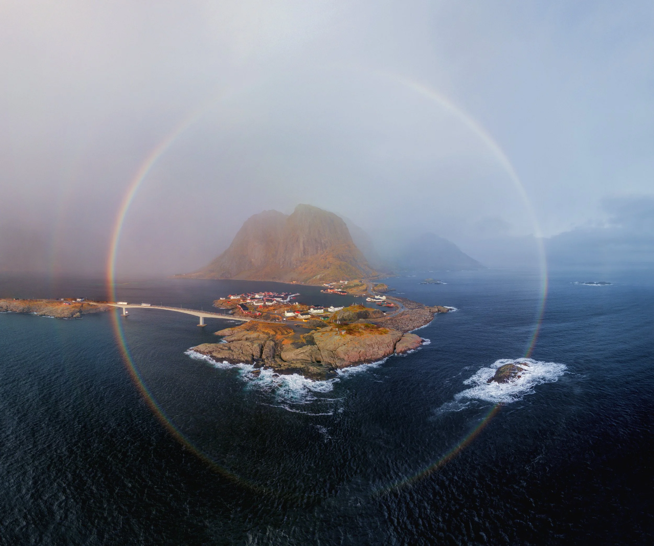
Full Circle Rainbow around Hamnoy
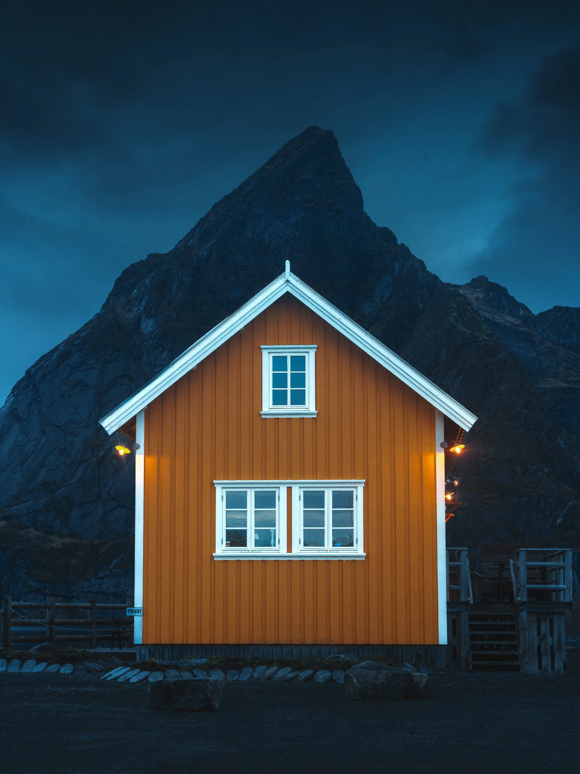
Sakrisoy: yellow huts, a pointed peak, and yet another rainbow
Two minutes down the E10 from Hamnoy sits Sakrisoy (Sakrisøy if you want to be proper about it), and it's the other Lofoten cliche I have absolutely no problem with. Where Hamnoy gives you the red rorbuer everyone has seen, Sakrisoy gives you the yellow ones, perched on a tiny island village pinched between sea and mountain, with the perfectly pointed Olstind looming over the top like it was placed there by a set designer.
If you've been doing Reine and Hamnoy, you'll have driven past it many times. Once the houses turn from red to yellow, you’re there!
There are really two shots here, and they're a few minutes apart. Well, I took two, there’s probably many more if I took the time to explore, but these are the famous ones.
First is the famous yellow hut. This is the shot that EVERYONE gets, and I mean everyone. The composition is simple, Hut in the middle of the rather symmetrical Olstind in the background. There is now a wooden viewing platform where you can take the famous composition. We visited in blue hour, moody days, and even popped in whilst the rainbows were whizzing across the fjords!
Blue hour, longer focal length, more compressed
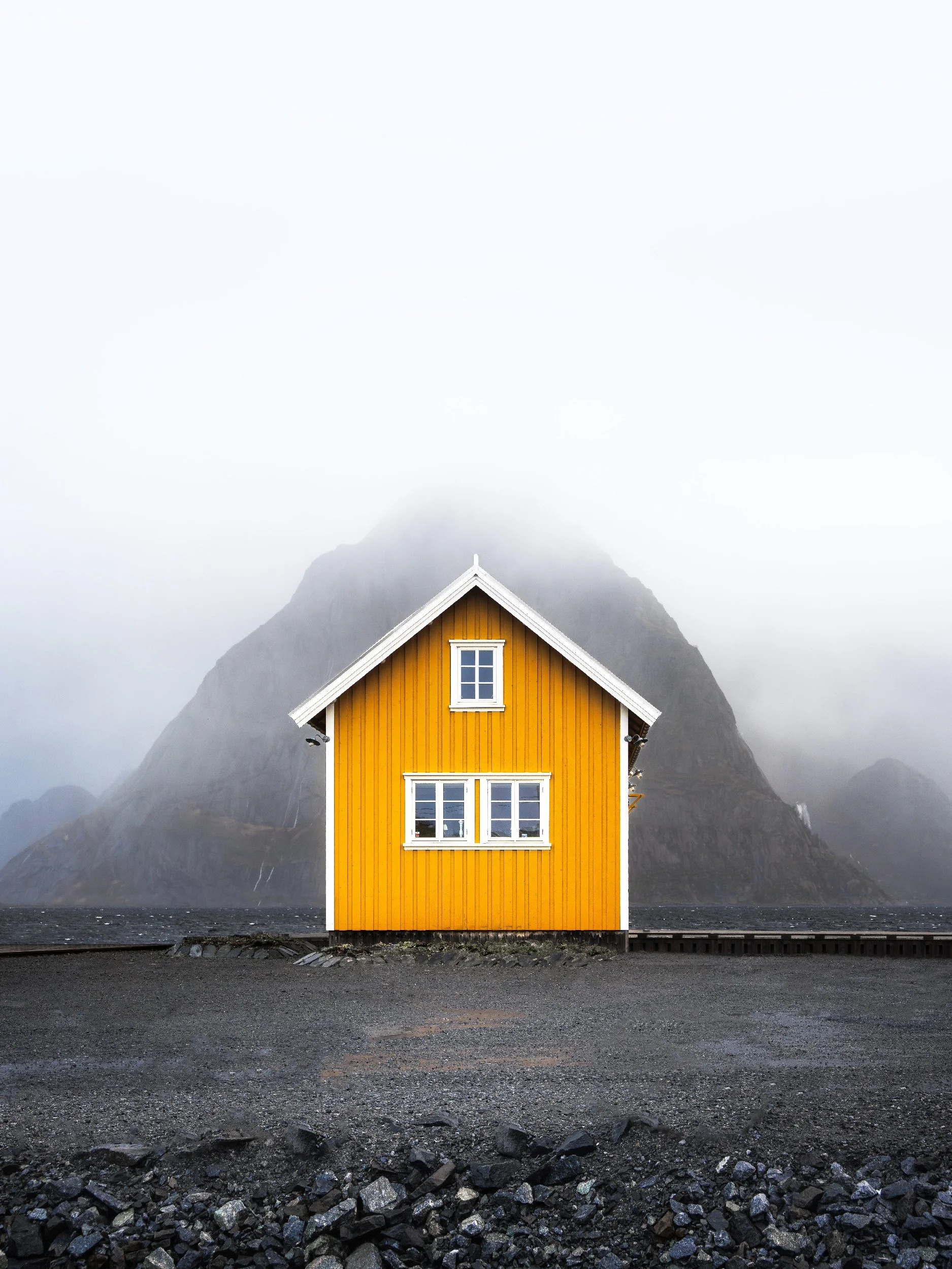
Rainy afternoon, wider view (rocks removed in photoshop)
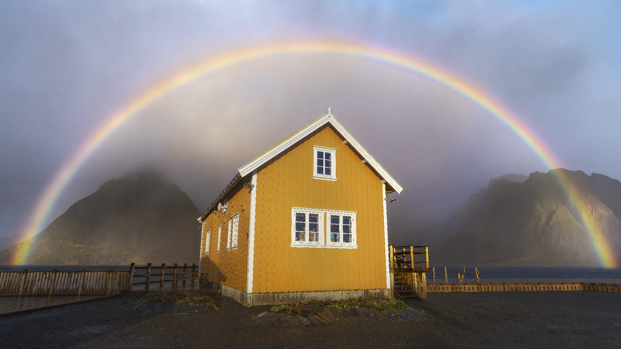
Rainbow over the Famous Yellow Hut
Then carry on along the E10 a stone’s throw to the Sakrisoy viewpoint. We just went on foot from the yellow hut, and you get the postcard composition: yellow huts in the mid-ground, Reinebringen in the background, the whole arrangement begging for a longer focal length to compress everything together.
Sakrisoy Village
Big Mountain View and Nusfjord: bank them on the same day
On the one morning we were properly promised dry weather, we strung two nearby spots together, and I'd suggest you do the same.
The are both off the same road that peels off the E10
The first stop before you get to Nusfjord is Big Mountain View, presumably because there is a big mountain and you view it. You can’t miss it, you drive round a corner and boom, there it is.
The low sun left the scene a touch unbalanced, lighting one side and not the other, so I worked a wide frame and a tighter one to see which held up. Cas grabbed the Fuji for a few gratuitous selfies. I look fine, thank you for asking.
Big Mountain Viewpoint, Lofoten (the longer focal length shot)
Insta-dickhead shot at the Big Mountain
Sexy Tony, Very Sexy
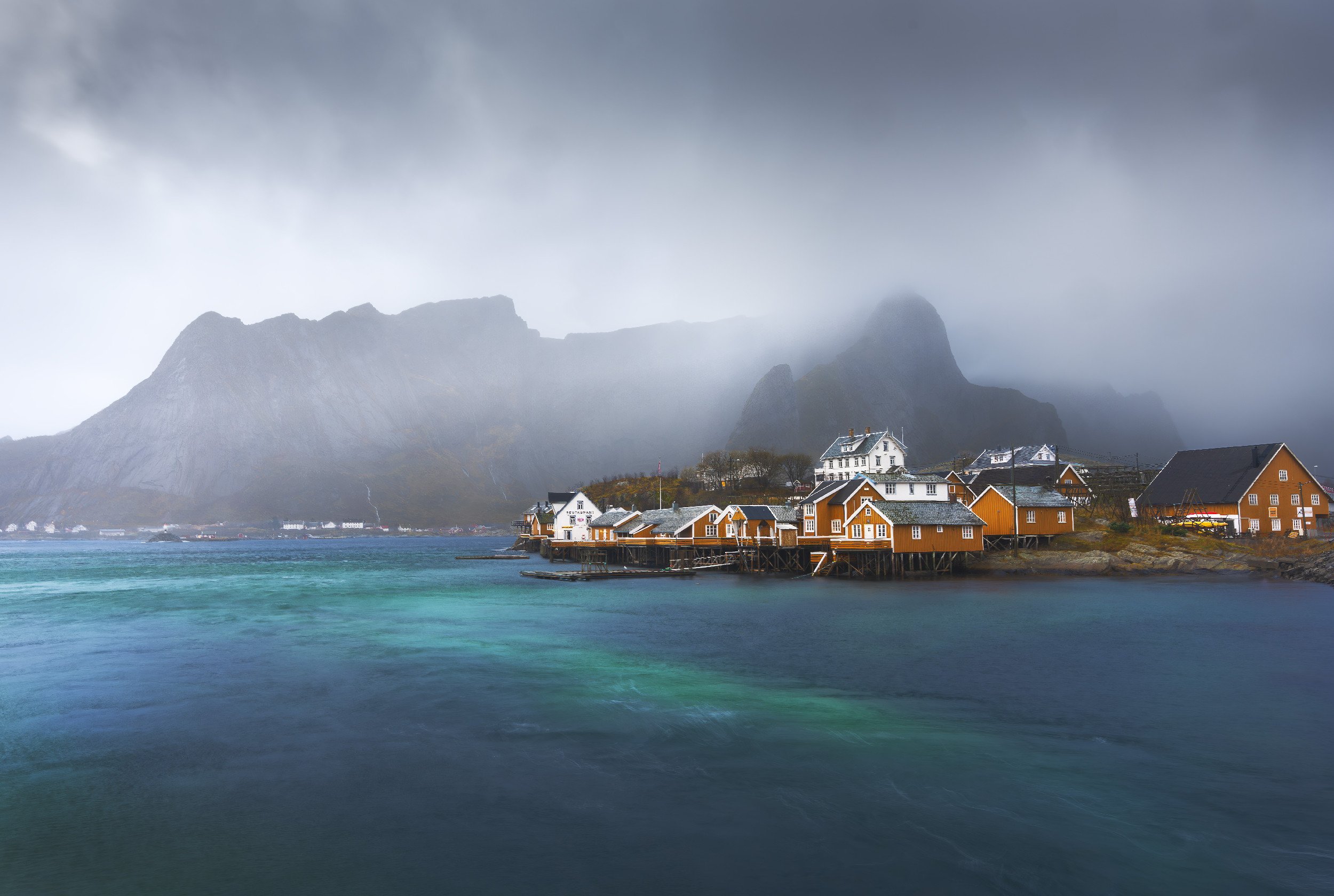
Then a very short drive down to Nusfjord, and this was a highlight. A preserved 19th century fishing village that feels like a living museum, all old yellow and red buildings catching the morning light as it poured down the fjord. I flattened the harbour water with an ND filter, then did the thing you should always make time for: put the camera down, bought a coffee and a pastry in a café stuffed with antiques, and watched the light move.
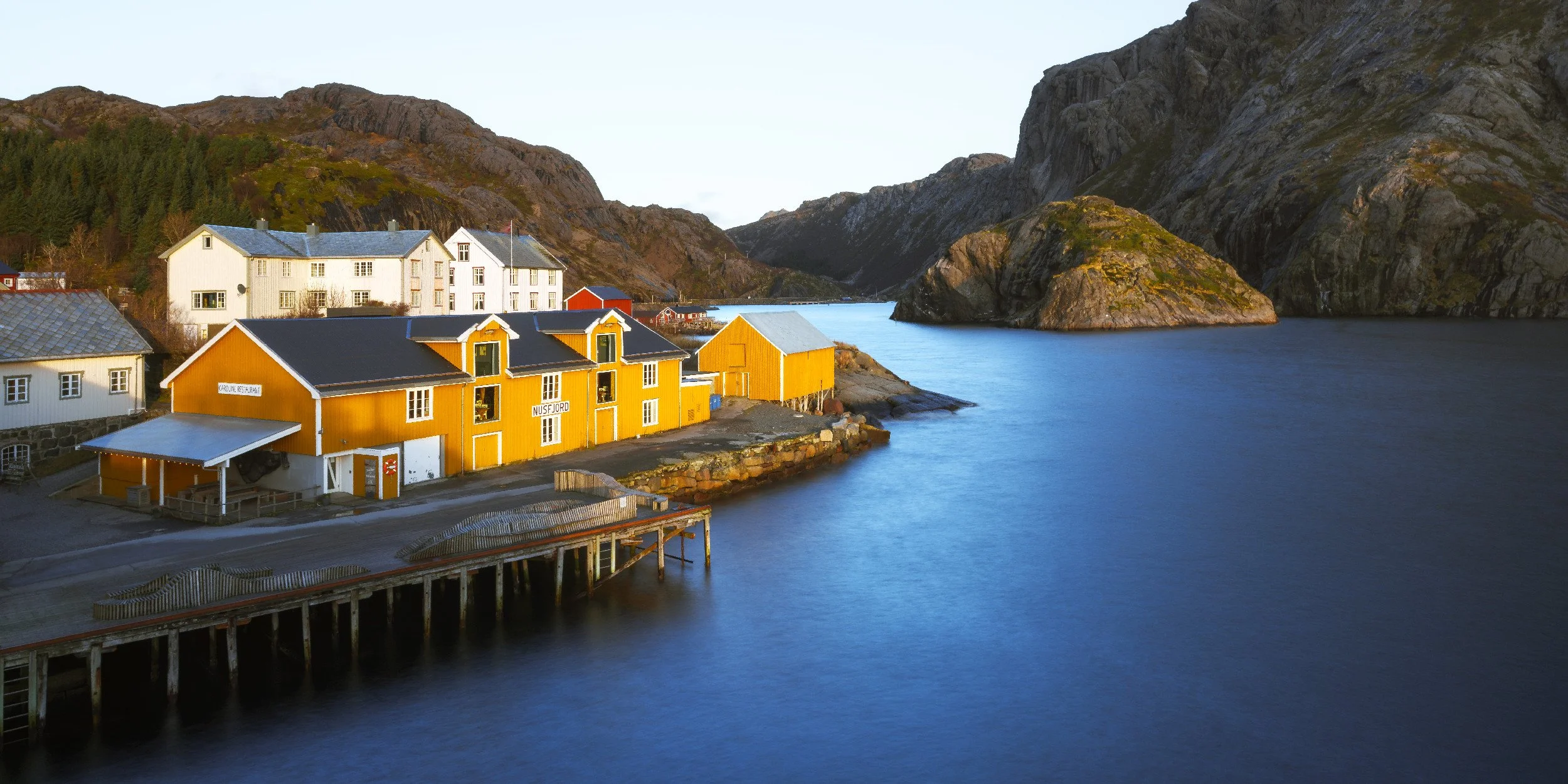
Nusjord, Lofoten. A view back up the Fjord
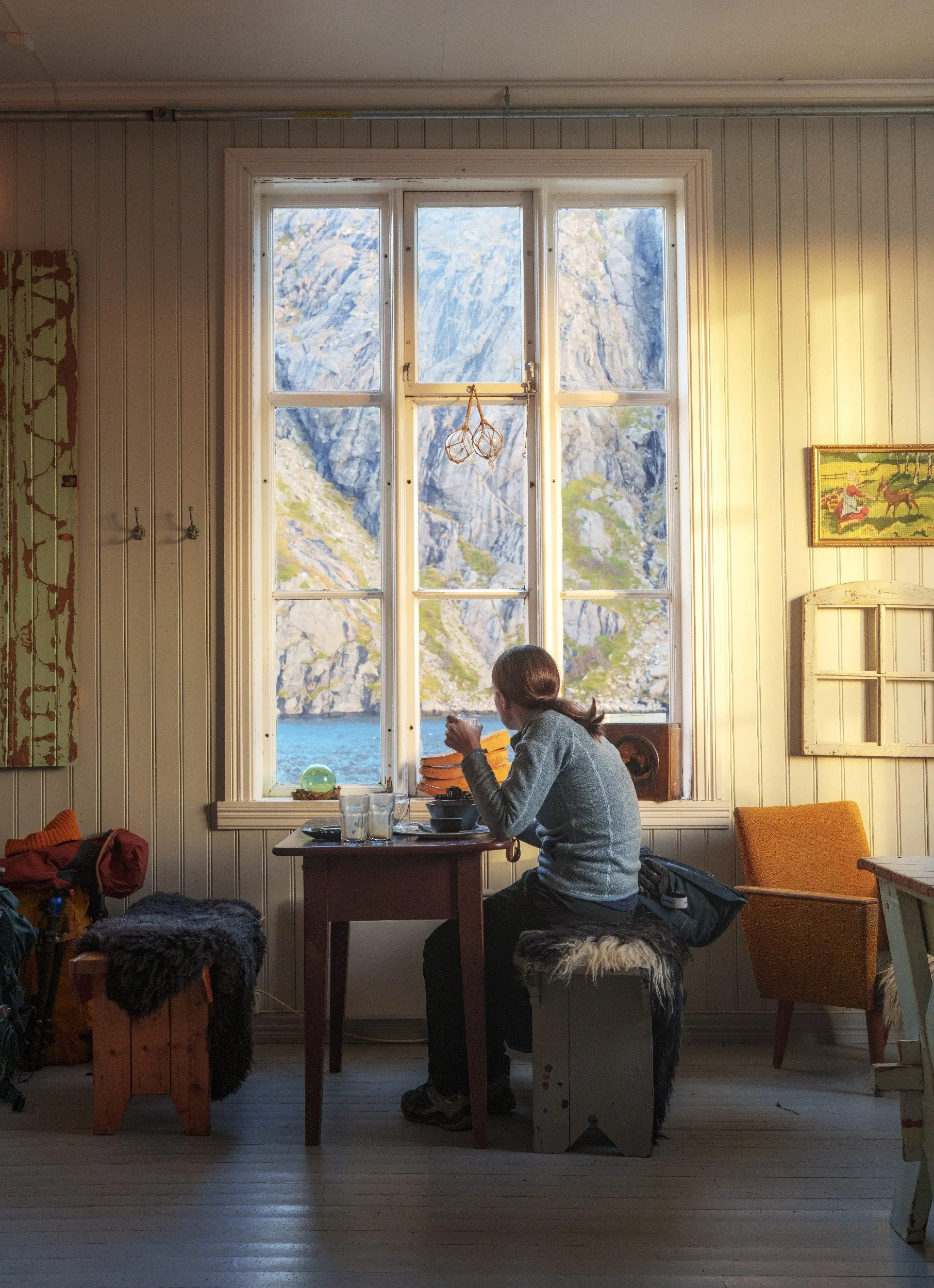
Always time for coffee and food
Morning light pouring into the Cafe
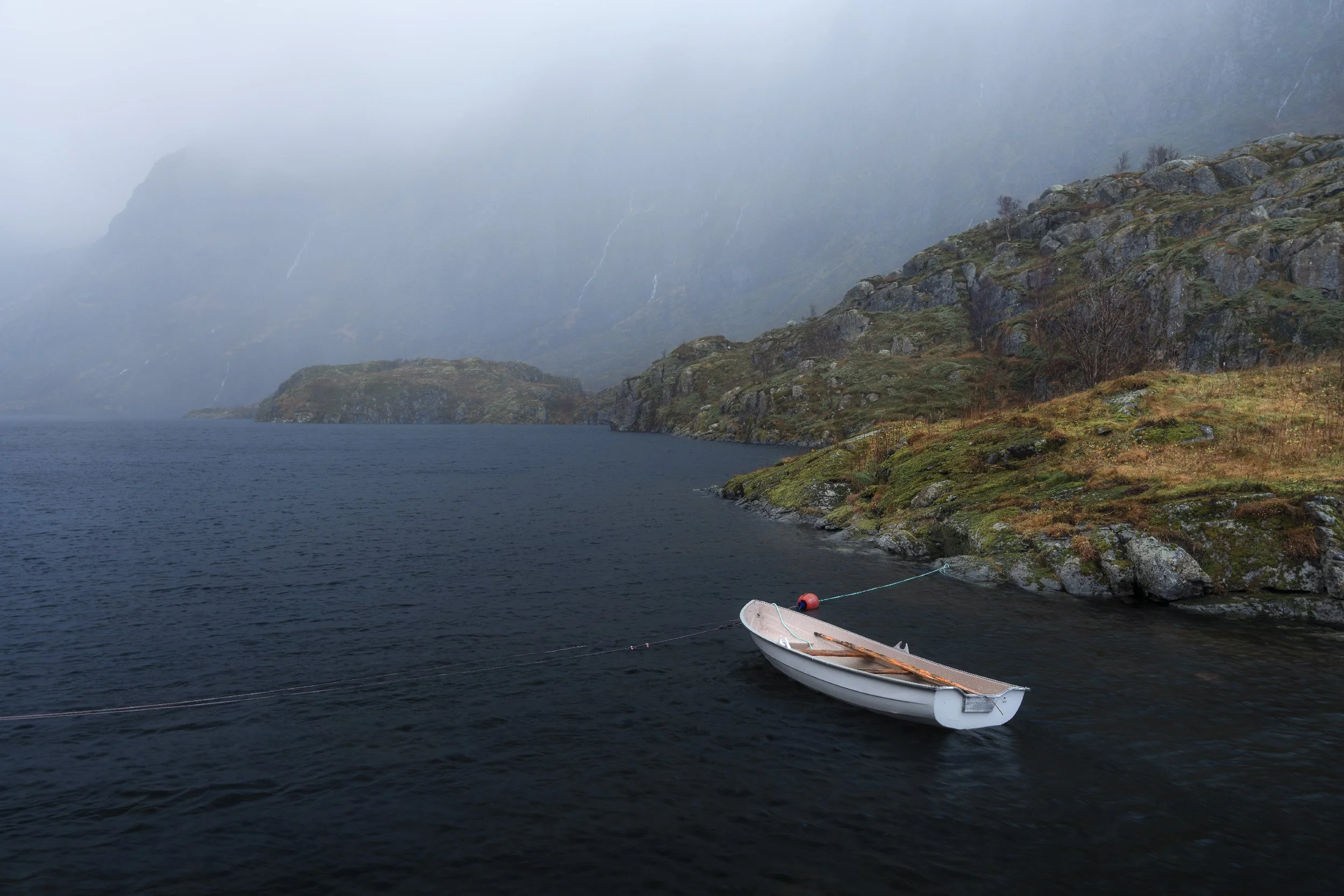
From the far end of the car park, a ten to fifteen minute walk leads up to a string of lakes with waterfalls, huts and woodland, and almost no one bothers to do it. Photography paradise, and quiet with it.
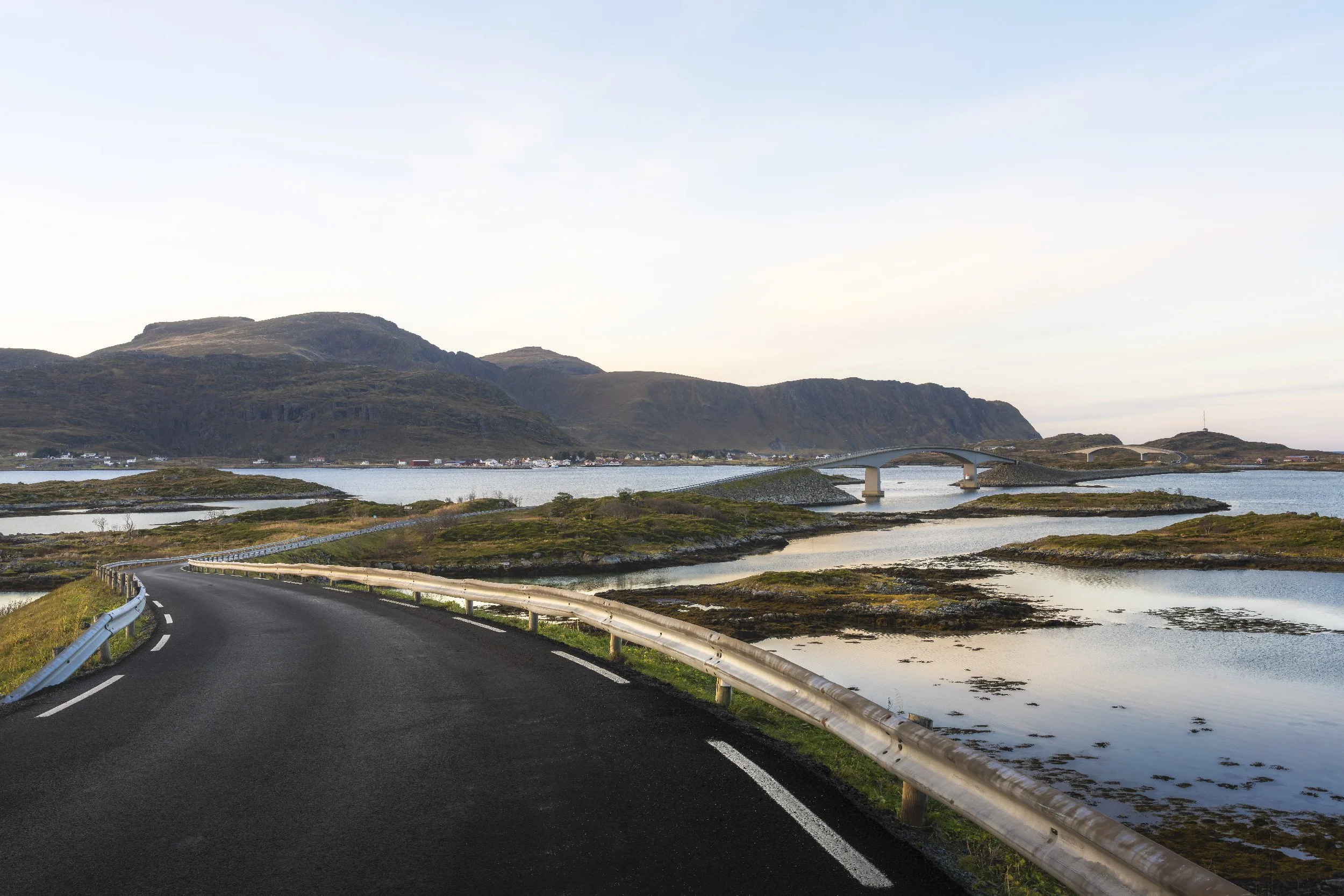
Fredvang: get your eyes in the air
Fredvang (I think I can pronounce this place!!) is all about the two slim bridges curving across the fjord, and it taught me a lesson about working a location properly. From the ground you can just about catch the bridges as swooping leading lines. Fine. But the place really opens up from above, so the drone went up and stayed up, shooting big 180 degree stitches, hunting the angle where the bridges lead the eye cleanly into the mountains.
View from hobbit eye level (E10 entrance to the bridges)
The best frame came on a second visit, shot from the opposite side so both bridges run up towards a lovely triangular peak, with a wall of rain on either edge of the pano and one improbable gap of clear sky right through the middle.
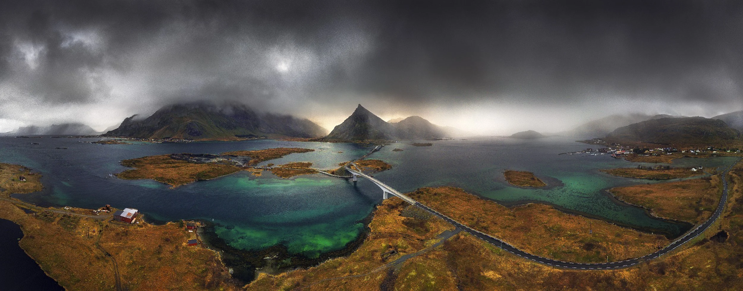
Drone Pano, looking back towards that beautiful triangular rock
When the drone batteries died, the X100VI came out for the bus stop and the gloriously mundane corners of the car park. Not every shot has to be the hero shot.
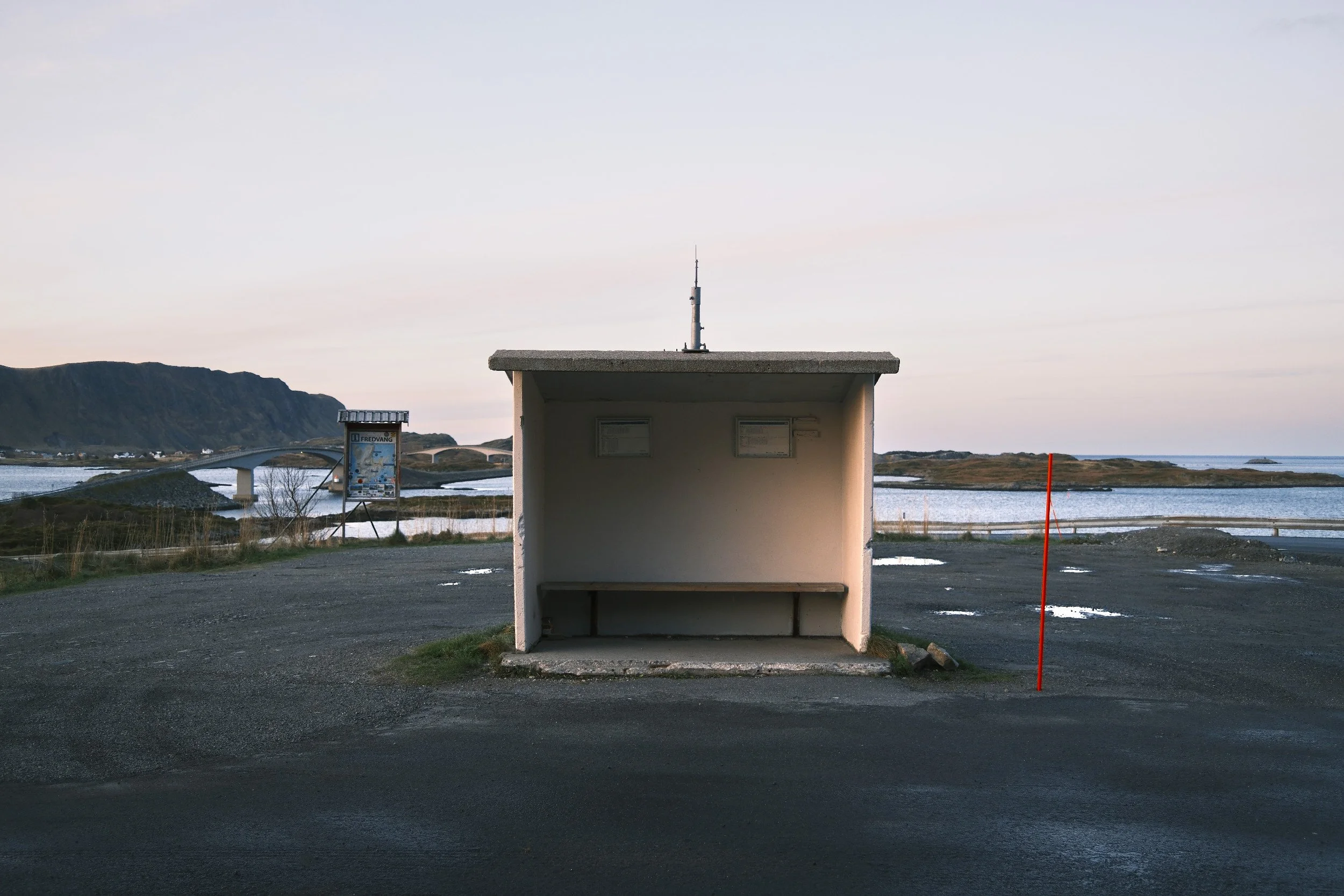
If you’re not driving, this is where you shall alight the bus
Uttakleiv and the famous rock pool
Drive over to the wild west coast north of Leknes and you'll find Uttakleiv, home to the rock pool every Lofoten photographer wants in their collection, the one they call the Devil’s Eye. It's a paid car park, around 40 kroner for three hours, with toilets, which after a week in the field was a rare comfort (if you can call it that…)
The polariser does the heavy lifting here, cutting the surface glare so you can actually see down into the pool and letting the colours pop. I used a three stop filter to take some of the chop off the sea, accepting that with this much ripple it was never going to glass over completely. Cas was busy alongside me playing with her own long exposures, and one of the shots in the YouTube video is hers, credit where it's due, but you’ll have to watch it to try and work it out.
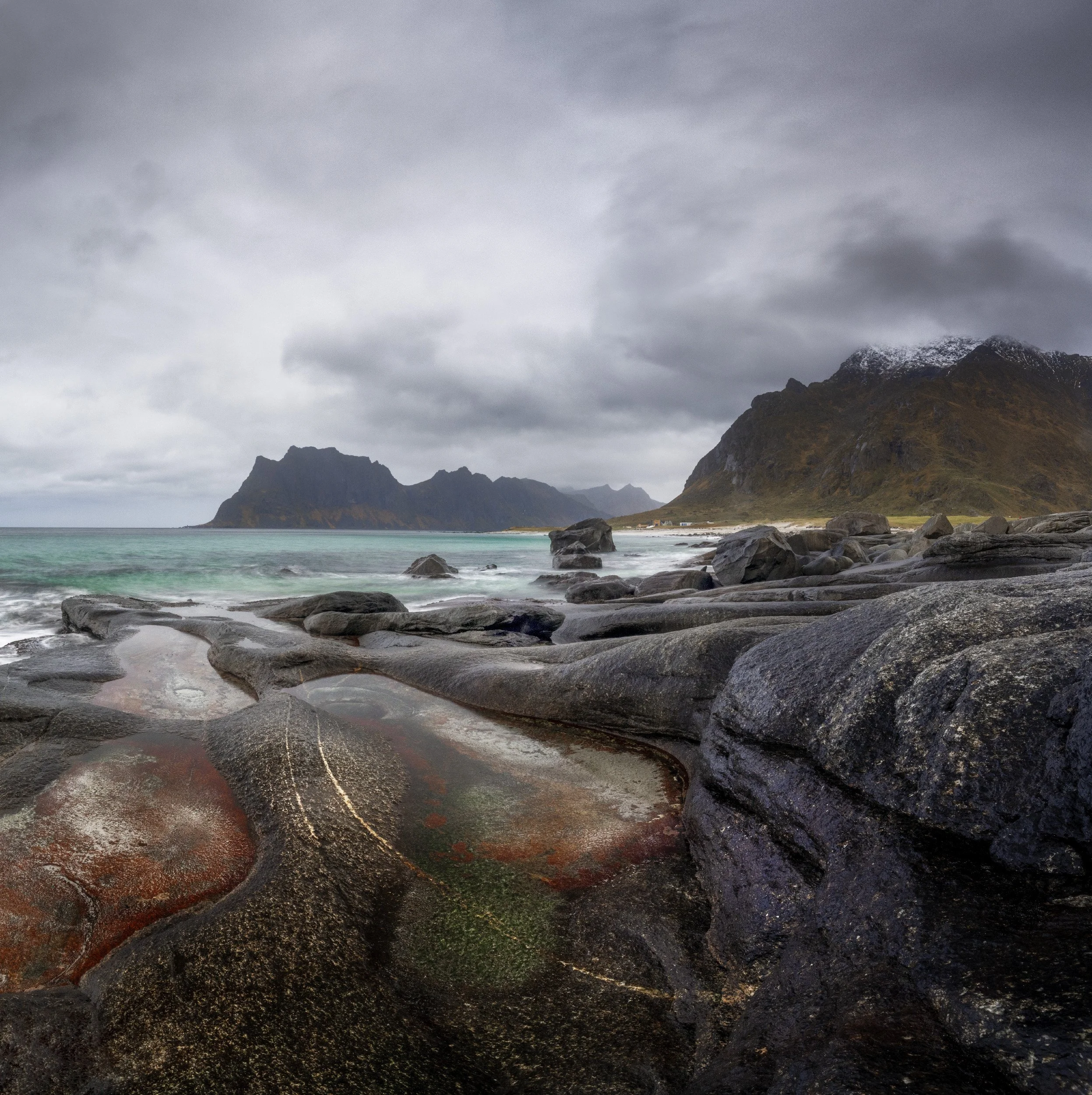
Panorama taken at the Devils Eye
On the soggy drive back I swapped to the full spectrum infrared camera for some 720 nanometre black and white, which is a brilliant trick for grey days because it cuts straight through the murk and gives you a dark, dramatic sea.
IR720 Moody Mountains
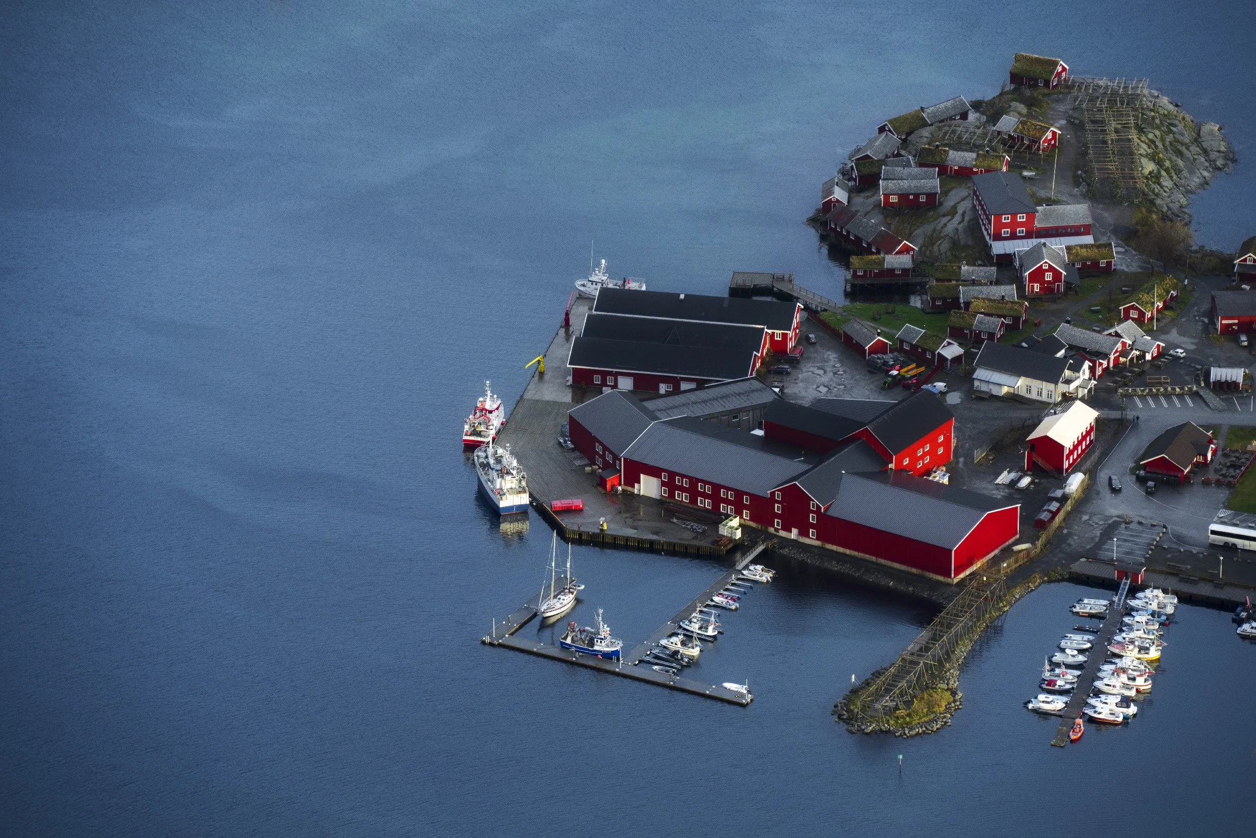
A: the end of the road
Right at the bottom of the archipelago, as far as the E10 will take you, sits Å (yes, just the one letter, and yes, it counts as a village). We arrived in heavy enough rain that a long exposure was hopeless, every two second frame just collected water on the front element, so I changed tack entirely and went after crashing waves instead.
The bridge over the mouth of Djupfjorden - On the way to A
This is where a wet day actually frees you up. With no chance of perfect honeypot light, the pressure lifts and you start documenting a place instead of chasing the one shot: the architecture, the mountains behind that someone genuinely sees from their kitchen window, the boats and whose they might be. Some of my favourite thinking happens on days like this, coat on, no plan, camera in hand. Makes it all the more special once you get a warm brew in your hand!
Moody mountains and a lone boat, A.
Dating back to the early 19th century, Å is a living museum much like Nusfjord. We wandered through its narrow lanes and discovered beautifully preserved fishermen’s cabins, historic boathouses housing traditional wooden vessels, and a cod-liver oil factory, established in 1850.
The view from the harbour wall back towards the village, with the mountains behind mostly obscured by the rain clouds passing through was too good not to capture.
The village of Å as seen from the Harbour Wall
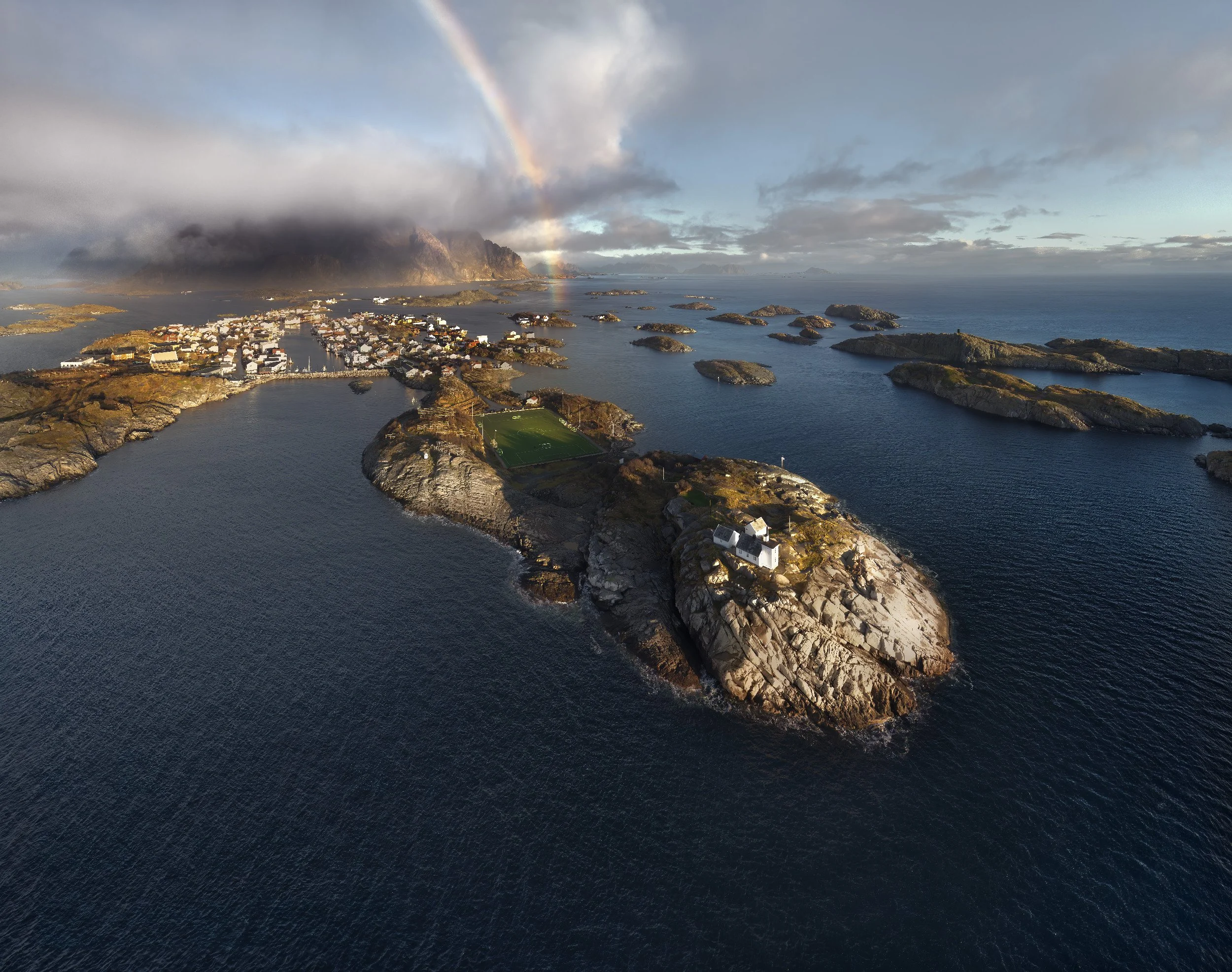
Henningsvar: the football pitch on the edge of the world
You've seen this one too, even if you didn't know its name. Henningsvar (Henningsvær) is home to the most famous drone shot in Lofoten, a full size football pitch perched on a spit of rock with the open sea on every side, little islands scattered around it and big mountains stacked behind. Astroturf at the edge of the world. It's every bit as daft and brilliant in person.
The village itself gets called the Venice of the North, its buildings sprawled across islands and linked by breakwaters, and the road in only arrived in the early 1980s, which makes it about as old as me….. The football pitch begs for a drone, and ours went up for another nervy flight over open water while a rainbow advanced across the scene faster than I could frame it. I won't pretend flying out over the deep blue doesn't have my nerves jangling, so I stayed conservative and leaned on panos again, wide angle through to 360 spheres, to get everything in without committing the drone to a watery grave. Worth every bead of sweat.
The rainbow over Henningsvar as the rain passed through
It does get a bit busy here. No-one is here to play football, just to put their drone up and grab the shot. Below is the straight down one you’ve probably seen all over the internet. But I did try to get a bit more adventurous with the panoramas for something a little different.
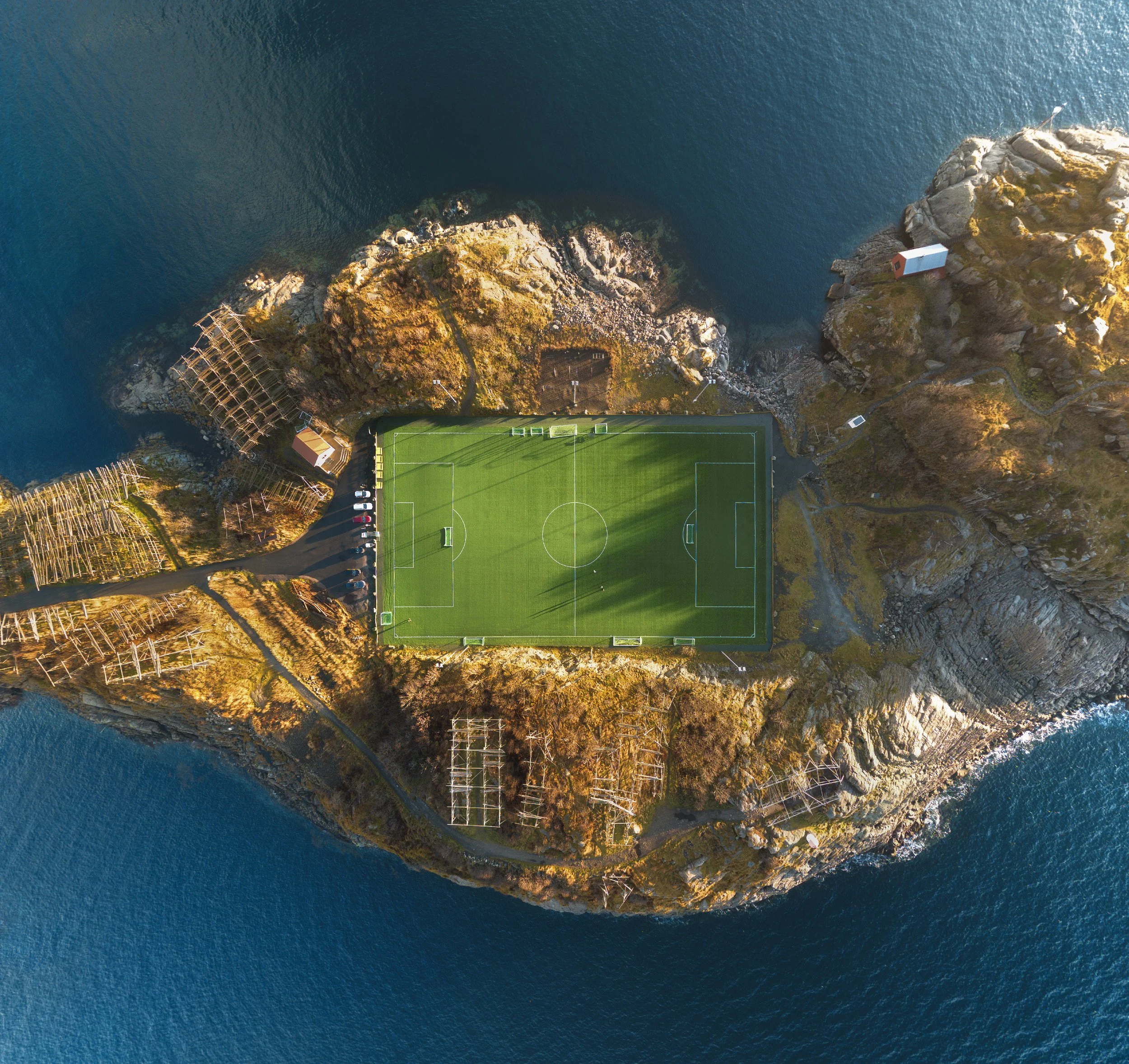
The shot everyone comes to Henningsvar to shoot
And then there's Reinebringen
There's one Lofoten location I've deliberately left out, because it's earned a post of its own: the leg-shredding climb up Reinebringen for the view back over Reine. Nearly two thousand steps, a 6am start in the dark, and conditions that were... let's say characterful. That one's coming as its own guide, so I'll save the moaning for then.
What was actually in the bag
Story first, gear second, but for the curious: the Sony A7R V did the bulk of it, the drone (DJI Air 3) earned a permanent place on this trip and is close to essential for Henningsvar, Fredvang and the Hamnoy rainbows, and a polariser and ND filter lived on the front of the lens for the fjords and rock pools. The surprise MVP was the full spectrum infrared camera, which turned several write-off grey days into moody black and whites. And the Fujifilm X100VI rode shotgun the whole way, check the video to see what that grabbed from the passenger seat without us even stopping.
What's next
From Å we turned the car north and started the long drive back towards Tromsø, which is the final leg of this Arctic Norway road trip and a story for the pillar post still to come, snow chasing us most of the way. Before that, though, there's Reinebringen and those two thousand steps to deal with.
If you'd rather watch the whole soggy, rainbow-streaked Lofoten leg unfold, the full video is over on my YouTube channel or watch part 1 below! And if you're planning the wider trip, start with the quieter, easier-to-love Senja guide, then come back here. The Reinebringen post will slot in alongside both very soon. Kettle on. You've earned it, and in Lofoten, you will need it.
Lofoten photography FAQ
Where is Lofoten and how do you get there? Lofoten is an archipelago off the coast of Arctic Norway, linked end to end by a single road, the E10, that runs from Svolvær down to the village of Å. The nearest airports are Svolvær and Leknes, usually reached via Bodø, or you can drive in along the E10 as we did, coming south from Tromsø and Senja. Either way you'll want a hire car, because the spots are spread along that road and nothing else gets you to them on a photographer's schedule.
When is the best time to photograph Lofoten? It depends what you're chasing. We went in November for moody winter light, snow on the peaks and a shot at the aurora, and got short days with the sun barely clearing the mountains, plus a fair amount of rain. For green landscapes and the midnight sun, go May to July. For winter drama, snow and northern lights, aim for late autumn through winter, just budget for filthy weather and few daylight hours. The grimmest days often gave us the best light.
What are the best photography locations in Lofoten? The honeypots worth your time are Reine and the red cabins at Hamnøy, the yellow huts at Sakrisøy, the preserved fishing village of Nusfjord, and the famous football pitch at Henningsvær. Add the bridges at Fredvang, the rock pool at Uttakleiv on the wild west coast, the working hamlet of Sund, and Å right at the bottom of the road. Almost all of them sit a short hop off the E10.
Where is the famous football pitch in Lofoten? The much-photographed football pitch is at Henningsvær, a fishing village built across a scatter of small islands on Lofoten's south coast and sometimes called the Venice of the North. The pitch sits on a spit of rock ringed by sea, and the classic shot is taken from directly above with a drone. It does get busy with photographers, so expect company.
Where are the yellow huts in Lofoten? The yellow rorbuer are at Sakrisøy, a tiny island village on the E10 between Hamnøy and Reine. They're the photogenic counterpart to Hamnøy's red cabins, with the pointed peak of Olstind behind them. There's a small viewing platform for the classic composition, and it's only a couple of minutes from both Reine and Hamnøy, so you can bag all three on one outing.
How many days do you need in Lofoten for photography? Give it at least four or five days if you can, and more if the weather's against you. The locations sit close together, but the light is short in winter and conditions change fast, so the extra days buy you the chance to revisit the honeypots until one of them finally delivers. We came back to Reine and Hamnøy again and again before they paid off.