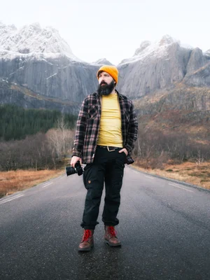
Climbing Reinebringen: 1,978 Steps to Lofoten's Most Famous View
Let me manage your expectations the way Lofoten managed mine. You climb nearly two thousand steps up the side of a mountain, in the dark, to stand at the one viewpoint every photographer covets, and the sky hands you... grey. Not golden hour. Grey hour. Cheers for that.
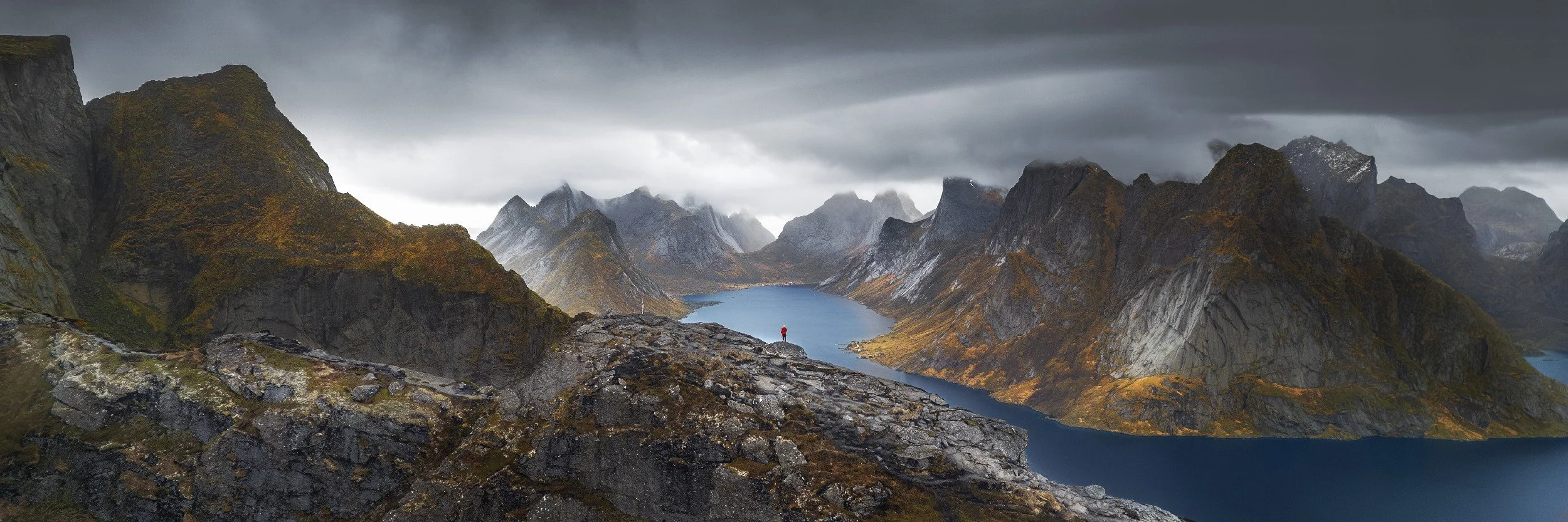
Panoramic view from Reinebringen
This is the Lofoten location I deliberately left out of the main guide, because Reinebringen (your guess at the pronunciation is as valid as mine) deserves its own story. It's the climb behind the photo you've definitely seen, the one looking down over Reine, its red cabins scattered across the water with the jagged peaks marching off into the distance. The view is worth every step. There are just rather a lot of steps.
Reinebringen: the quick version
- Where: Directly above the village of Reine, Lofoten, Arctic Norway. A 448 metre peak.
- The climb: 1,978 stone steps, built by Nepalese sherpas. Steep and sustained, but not technical.
- Trailhead: Park at Reine harbour, walk back towards the road tunnel, trailhead is just up to the left of it.
- How long: Roughly an hour to ninety minutes up. We were out nearly six hours all in, working the light.
- When we went: November. A 6.38am start in the dark, and no sunrise to speak of.
- In the bag: Sony A7R V, 10mm for the time-lapse, a 20-200mm for detail shots, DJI Air 3 drone, tripod, flask and snacks
- Worth knowing: Really a snow-free-season climb, ice and avalanche risk in winter. Drone flying is tricky here: 120m rule on a ridgeline, and it gets busy.
Before the hike, there’s the hike to the hike…
Reinebringen is the 448 metre peak that rises straight up behind the village of Reine, and the reason it's become a pilgrimage is the staircase. For years the path was a notorious mudslide that wrecked the hillside and the occasional ankle, until a team of Nepalese sherpas built a stone staircase up the worst of it. 1,978 steps, to be precise, a number I have feelings about that I'll get to shortly...
Getting to the start is simple. Park at the harbour in Reine, walk back through the town towards the road tunnel, and the trailhead sits just up to the left of the tunnel mouth. You can't really miss it. From there it is, quite literally, up.
We picked our morning carefully. It was our best shot at half-decent weather and a possible sunrise before we left Lofoten, though I'd be lying if I said I was confident. Putting my hiking boots on in the car park I couldn’t see any stars.
The climb: 1,978 steps and a grudge
We hit the trailhead at 6.38am with blue hour just creeping in, head torches on, looking up at a staircase that vanished into the clouds. And here's my one real complaint about Reinebringen, lodged formally and for the record: 1,978 steps. They were so close. Couldn’t they just add another 22 and let me say I climbed two thousand?
Up we went. The thing the photos never convey is how steep it is. Genuinely, properly steep, the don’t look down or you’ll get wobbly knee’s steep. Although going up, you don’t tend to look back, and in the dark, visibility was limited anyway (it’s the slog down that gets you…)
By somewhere past step 1,500, three quarters of the way up, the lactic acid burn was intense and we'd climbed so high we were now standing inside a cloud. Golden hour, in theory, was starting. Golden hour, in practice, was not happening. Just that flat grey murk rolling over the ridge.
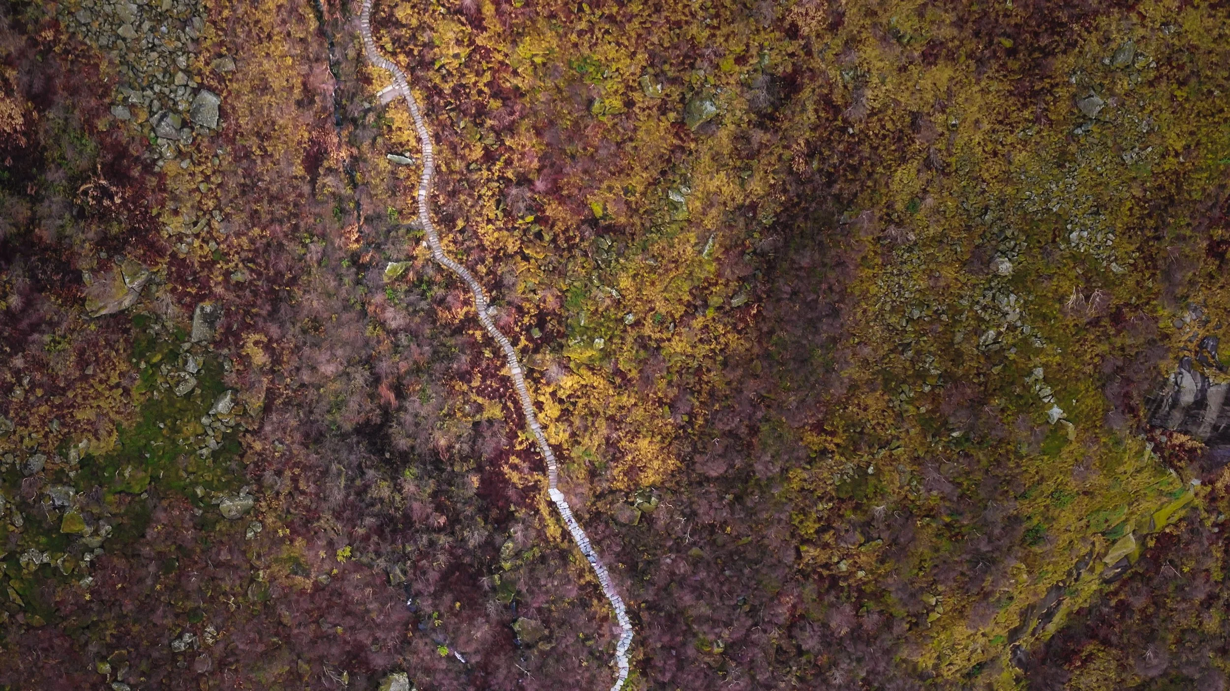
The stairs from above, not showing how steep it really is!
So we did the only sensible thing. We stopped, caught our breath, and waited. There's no sense rushing to a summit that's padded in fluffy clouds, and besides, we had coffee to drink. The cloud was forecast to lift within the hour, and on a mountain, an hour of patience is rarely wasted.

Heading to Lofoten next?
The Lofoten Photography Guide
Skip the wrong turns I made. Seventeen locations mapped north to south down the E10, with the light, the compositions and the honest logistics for each. Instant PDF, £16.99.
The reward at the top, and the bit past the top
Once you crest the staircase you hit the ridge, and the view opens up. But the actual trig point sits another 60 metres or so higher, up a scramble of mud and rock that's a good deal rougher than the steps you've just survived. It's worth doing for the full panorama, just mind your footing, because it's a proper drop on either side and far more exposed than the staircase.
And then, the payoff. Not the postcard sunrise, but something better in its own way. The cloud we'd been cursing started moving fast around the peaks, sweeping in and tearing apart, revealing and hiding the fjords and islands below in turn. I got a 10mm lens on and ran a time-lapse at two second intervals just to capture that movement. Landscape photography is, more than anything, a game of patience. Stay warm and awake long enough on top of a mountain and more often than not it pays off, and it paid us back here with one of the moodiest, most dramatic scenes I've ever had the pleasure of pointing a camera at. Grey hour, it turns out, has its moments.
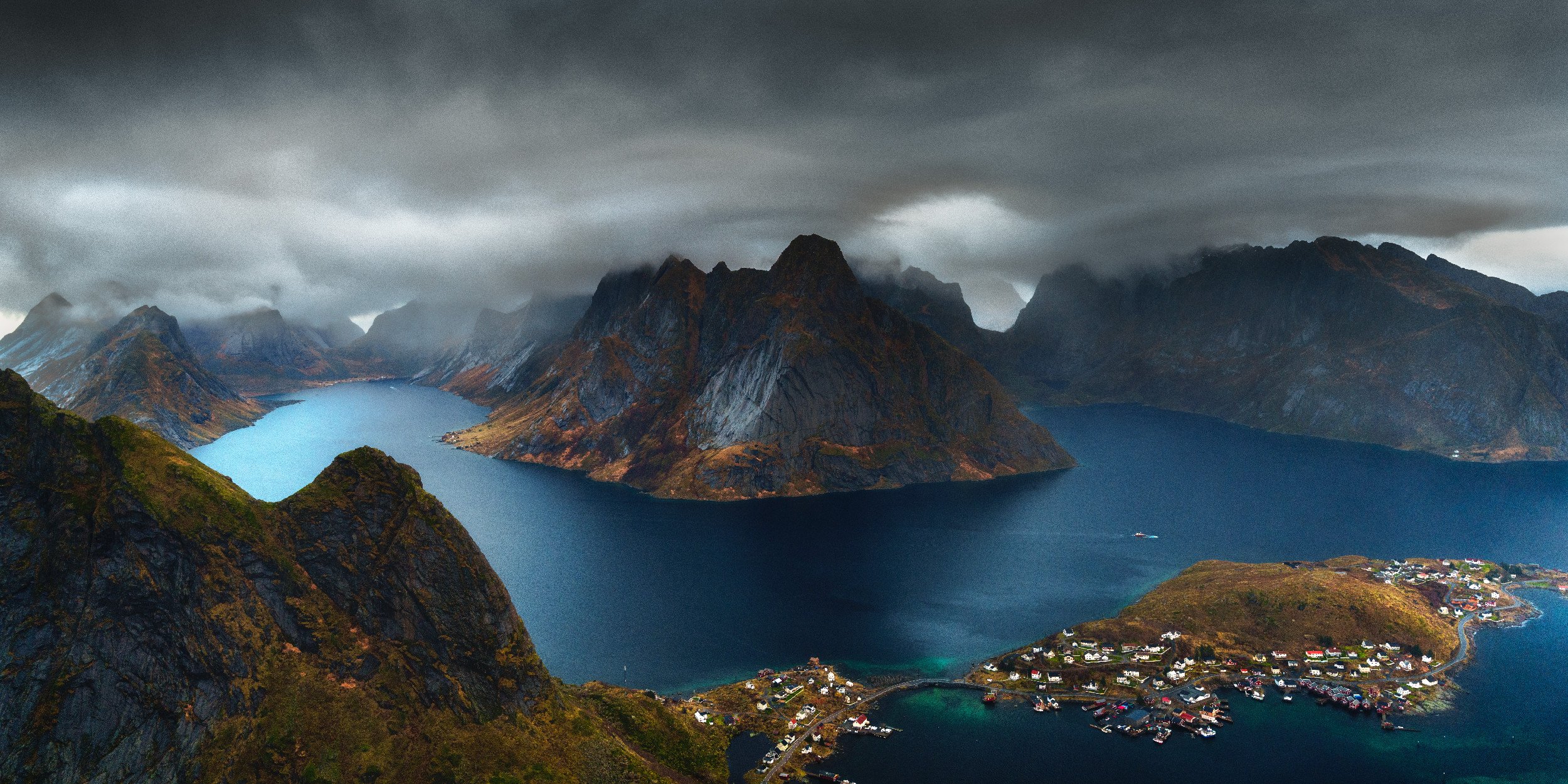
Moody Peaks as seen from the Reinebringen Trig Point
A quick word about the rocks, because I can't help myself
Indulge me. Did you collect rocks as a kid? I did, and I never grew out of it. The mountains around Reine are made of ancient pre-Cambrian metamorphic rock, some of the oldest and most erosion-resistant stuff on the planet, and it's that sheer hardness that lets them hold these absurd knife-edge peaks. Tectonic uplift shoved it skyward, glaciers carved it into shape over millions of years, and what's left is the dramatic skyline you've hauled yourself up to photograph. You don't need to know any of that to take the shot. But I think it makes you look at it differently, and looking differently is most of the job.
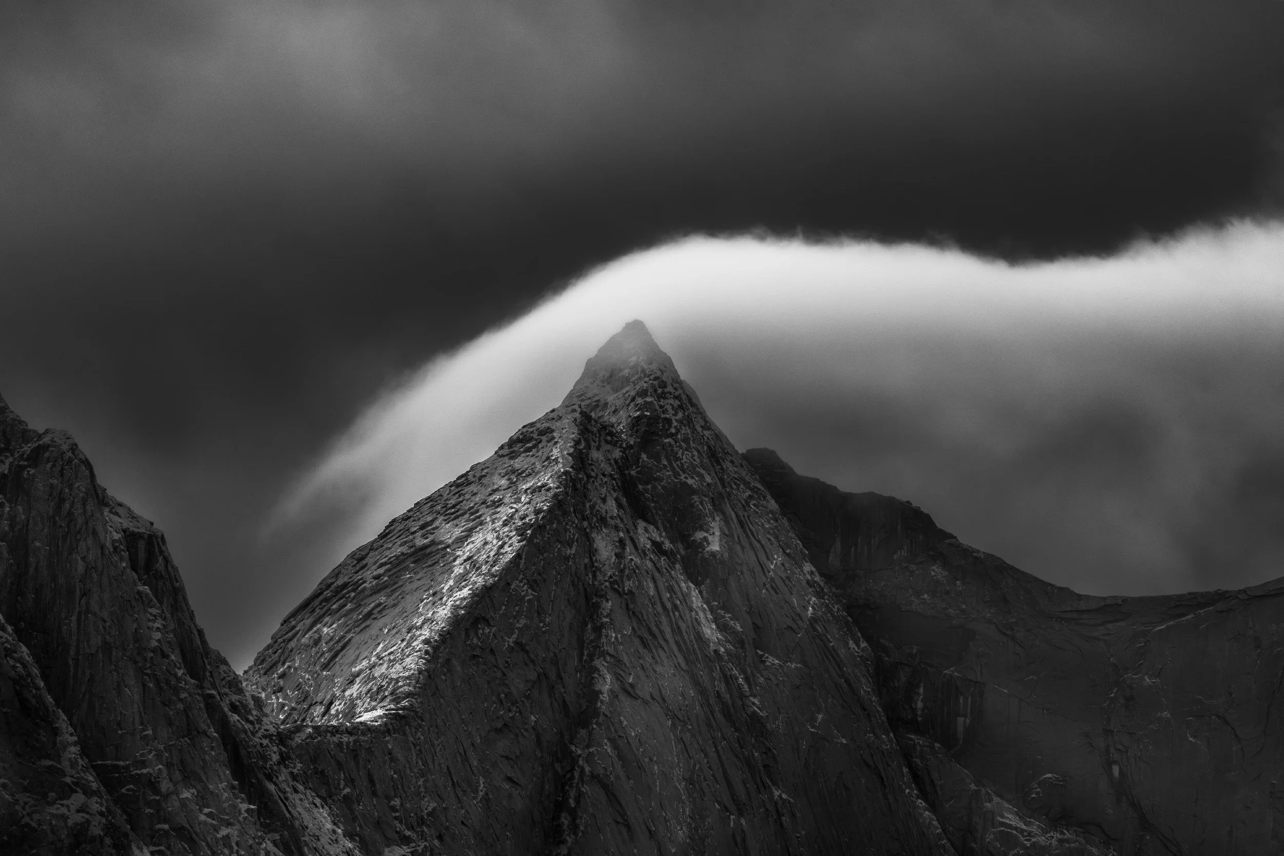
IR 720nm Shot of peaks opposite Reinebringen
Shooting from the summit
A few honest pointers on the photography, because Reinebringen is not quite the open buffet you might expect. The well-trodden eye-level viewpoints are surprisingly limited, hemmed in by the terrain, though you can still hunt out a decent foreground rock or two to anchor the classic view down over Reine.
Where it really comes alive is from the air. The drone gives you a perspective you simply cannot get on foot. Beyond that, the vista is just enormous, far too big for a single frame, so I spent a lot of time stitching panoramas to fit everything in. Wide ones, big sweeping ones, whatever it took. When the scene won't fit the lens, make a bigger lens. Putting on a longer lens (Cas’s 20-200mm) also allowed some amazing handheld detail shots of the villages, roads and islands below.
Be wary of the drone though. When I went we weren’t in a no-fly zone (national park) but the 120m from any landmass rule always applies and it’s harder to keep that on a ridgeline. Also you can’t flying non-consenting people and it can be a very busy spot. Getting up there first before anyone else helps with that though, but at other times of day/year you may find it very difficult to fly responsibly.
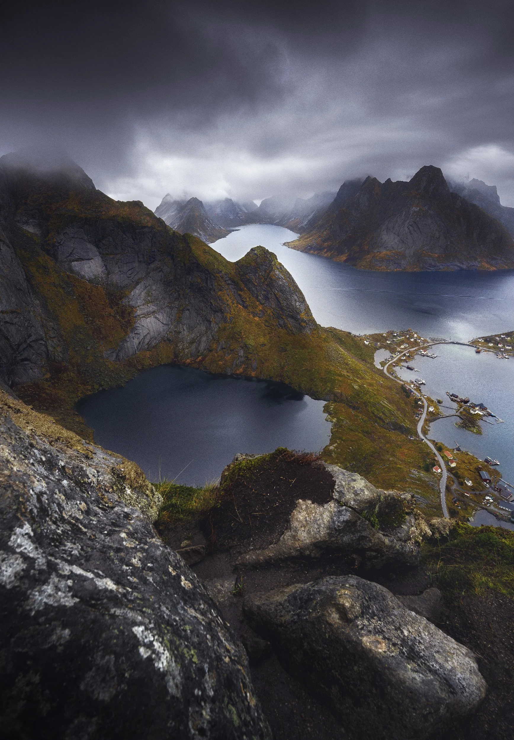
Rocky Foreground shot from near the Reinbringen Trig Point
What to know before you climb
The practical bits, so you arrive better prepared than my legs were.
It's a steep, sustained climb up roughly 1,978 stone steps, and while it's not technical, it is a genuine effort. Most people manage the steps in around an hour to ninety minutes, but as a photographer you'll want far longer up top, so don't plan it tight. We were out for the better part of six hours all in, most of that spent waiting for and working the light.
Take a head torch if you're going up for blue hour or sunrise, layers for the summit because you cool down fast the moment you stop moving, and footwear with proper grip. The trig point scramble beyond the steps is muddy, rocky and exposed, so treat it with respect or skip it. And a serious note: the staircase is really a snow-free-season affair. In genuine winter conditions the climb gets hazardous with ice and avalanche risk, so check the local advice and be honest with yourself about turning back. We went in November and got away with mud and cloud rather than deep snow, but that's a roll of the dice I wouldn't always recommend.
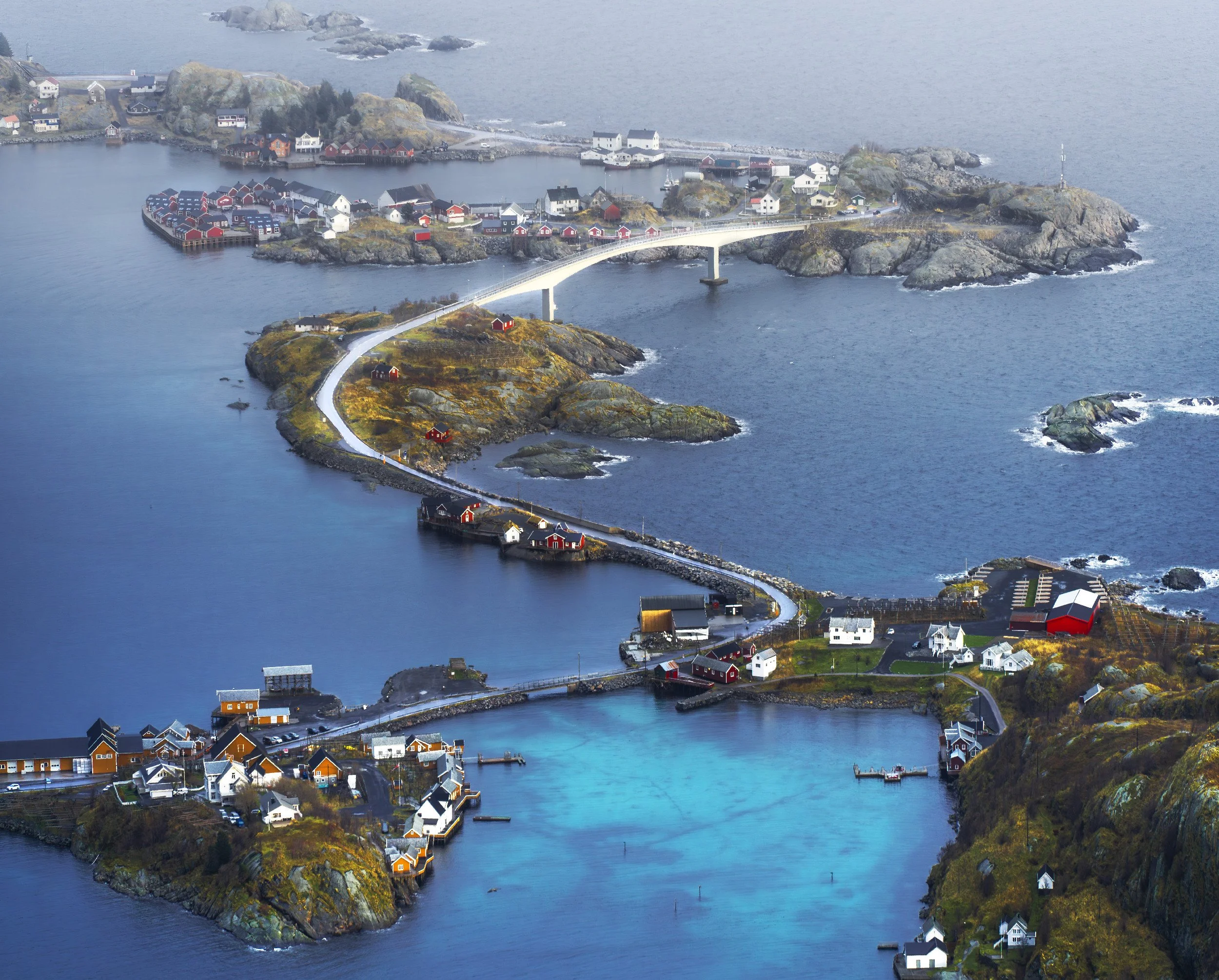
An example of what you can grab at 200mm from the trig point.
What was in the bag
The Sony A7R V and a wide lens for the classic view, a 10mm for the summit time-lapse, and the DJI Air 3 drone. A 20-200mm super zoom is great, lightweight and better than lumping up a 100-400mm! 200mm should be plenty from up here. A sturdy tripod for the slow stuff/timelapse, and frankly the most valuable item of all: a flask of the hot caffeinated beverage of your choice. Oh, and snacks! Check out my gear page for the latest contents of my Shimoda backpack.
What's next
After an arduous knee-destroying trek back down, we did what any sane person does, stopped at a few spots to catch the last of the day's light on the way back to warmth and, more importantly grabbed a coffee and sugary snacks at the petrol station in Reine.
Reinebringen rounds out the Lofoten leg, and with it the three chapters of this Arctic Norway trip: quiet Senja, the famous Lofoten honeypots, and this brute of a climb. The whole thing, Tromsø down to Å and back, is tied together in the Arctic Norway road trip overview.
And if you're planning your own assault on those steps, every spot along the E10 is mapped and written up in my Lofoten photography guide, Reinebringen included. Make sure that assault is coordinated!!
If you'd rather watch the whole soggy, cloud-wreathed climb unfold, including the despair half way up the mountain, the full video is over on my YouTube channel. Hopefully just reading about those steps hasn’t worn you out too much!
Reinebringen FAQ
How many steps are there up Reinebringen? There are 1,978 stone steps up Reinebringen, laid by a team of Nepalese sherpas to replace what had become a notorious mudslide of a path. Twenty two short of a round two thousand, which I have chosen to take personally.
How long does it take to hike Reinebringen? Most people manage the steps in around an hour to ninety minutes each way, depending on fitness and how often you stop to wheeze. As a photographer, budget far longer. We were out for the better part of six hours in total, most of that spent at the top waiting for the cloud to do something interesting.
How hard is the Reinebringen hike? It's steep and sustained rather than technical. There's no scrambling or exposure on the staircase itself, but it climbs 448 metres in a very short distance, so it's a genuine leg-burner and you'll feel it on the way down as much as the way up. The optional trig point beyond the top of the steps is a different matter: 60 metres of mud and rock, properly exposed, and worth skipping if conditions are poor.
Where do you park for Reinebringen? Park at the harbour in Reine, then walk back through the town towards the road tunnel. The trailhead sits just up to the left of the tunnel mouth and is hard to miss. There is no parking at the trailhead itself, so don't try to shortcut it.
Can you hike Reinebringen in winter? The staircase is really a snow-free-season route. In genuine winter conditions it becomes hazardous with ice and avalanche risk, so check local advice before you commit and be honest with yourself about turning back. We climbed in November and got away with mud and low cloud rather than deep snow, but that was a roll of the dice rather than a plan.
Can you fly a drone at Reinebringen? When we visited it wasn't a no-fly zone, but the usual rules still apply and they're harder to honour on a ridgeline: keep 120 metres from any landmass, and don't fly over people who haven't consented, which is a real constraint because the summit gets busy. Getting up there first thing helps enormously. At busier times of day or year, flying responsibly may simply not be possible, so check the current restrictions before you go.